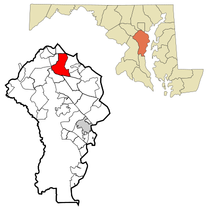
Glen Burnie, with its neighbor Linthicum, has a population of about 45,000 in Central Maryland, just south of Baltimore. It is home to BWI Airport.
Understand
editIn 1812, Elias Glenn, a district attorney, established a county seat near what is now known as Brooklyn Park. He named his property "Glennsburne".
The name was changed to "Glennsbourne Farm", and eventually "Glenburnie", as the property was passed through Glenn's descendants. Records also show the name as "Tracey's Station" and "Myrtle", after local postmaster Samuel Sewell Tracey and one of Tracey's boarders, before the final decision was made.
In 1854, William Wilkins Glenn, Elias Glenn's grandson, incorporated the Curtis Creek Mining, Furnace and Manufacturing Company into his family's property. The business flourished during the 19th century, and with it came several thousand acres of land in northern Anne Arundel County.
Upon the death of William Wilkins Glenn, his son, brother and nephew began to manage the family's business affairs, and Glenburnie became an official state subdivision in 1888. The Glenn family contracted George T. Melvin and Henry S. Mancha to lay out and promote the town. It would not be until 1930 that postmaster Louis J. DeAlba decided two words were better than one, and changed the town's name to Glen Burnie.
Get in
editBy plane
edit- 1 Baltimore-Washington Thurgood Marshall International Airport (BWI IATA), ☏ +1 410 859-7111. Baltimore's main airport and one of the three major airports for Washington, D.C.. It is just west of Glen Burnie. Parking rates for 24 hours: $22/hourly garage, $12/daily garage, $10/Express lot, $8/Long term lot.
By car
editGlen Burnie and Linthicum are surrounded by all the major highways in the area—I-95, I-895, and MD-295 (Baltimore-Washington Parkway) are all just west, MD-100 is south, I-695 (Baltimore Beltway) is north, and MD-10 (Arundel Expwy) is east. I-195 cuts east through the three western highways and leads directly to BWI.
By rail
editThe Marc Train Penn Line stops at BWI on its route between D.C.'s Union Station and Baltimore's Penn Station. Baltimore's Light Rail (which also goes to Penn Station) has five stops in the area, including its southern termini at BWI and Cromwell/Glen Burnie. Amtrak has three lines stopping at BWI: Acela Express, Northeast Regional, and Vermonter, connecting BWI to Baltimore, D.C., and most points northeast.
By bus
editGet around
editSee
edit- 1 Thomas A. Dixon Jr. Aircraft Observation Area, 1911 Dorsey Rd, ☏ +1 410 222-7300. Set on a paved loop trail, this observation area offers airport views, a playground & parking to the nearby Friendship Park.
Do
edit- 1 Glen Burnie Outdoor Ice Skating, 103 Crain Hwy, ☏ +1 410 590-5990.
Buy
edit- 1 Marley Station Mall, 7900 Ritchie Highway (Rte. 2, just north of Rte. 100), ☏ +1 410 766-2033. M-Sa 10AM-9PM, Su 11AM-6PM. Lots of national chains such as Macy's, JCPenney, Bath & Body Works. It's a mall; knock yourself out.
Eat
edit- 1 Crabtowne USA, 1500 Crain Hwy S, ☏ +1 410 761-6118. 9AM-11PM. Veteran stop for steamed & fried crab, shrimp & fish, with a vast range of old-school arcade games.
- 2 Honey Bee Diner (Bee Diner), 7346 Ritchie Hwy, ☏ +1 410 761-0477. 24 hours. Hearty breakfasts, sandwiches & steaks are featured at this retro-style American diner.


