Canada may be overshadowed by its southern neighbour the United States with regards to car dependency, but alas, getting around Canada without a car between or outside the cores of its large cities can still be quite difficult, and often requires careful planning in advance.
Understand
editCanada's northern geography, relatively small population, and large size means that its cities are all concentrated in a few corridors with large expanses of near-empty land between it. As with their American counterparts in the 20th century, Canadian cities removed most of their streetcar networks and embraced automobile-oriented suburbs. However, unlike the United States, Canada's freeway network did not develop to be as extensive as down south across the border.
Unlike Australian cities, commuter or suburban rail systems are far more limited in Canadian cities, though a traveller visiting Canada's major cities will find the buses to be a bit more frequent than their American or Australian counterparts. Though, unlike American systems, most Canadian cities are investing in expanding transit and cycling options within; and there are rumblings about high-speed rail between Quebec and Toronto, though it is still quite far from reality.
Still, many travellers want to get around without a car, whether for lack of a driver's licence, to save money, or to minimize environmental footprint. For both local and intercity public transport, information is generally readily available online, whether through the transit agencies or via Google Maps, means that it is viable to plan trips ahead of time.
By train
edit- Main article: Rail travel in Canada

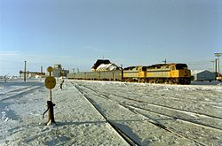
Canada's intercity and national rail system is quite underdeveloped compared to the rest of the developed world. The experience is often far from pleasant. Delays can be common with outdated rolling stock, the use of freight tracks, as well as the experience of bringing luggage on board that can mimic the pain of flying while also taking longer than driving.
Better served areas
editIntercity rail travel is most viable in the Quebec City-Windsor corridor. Cities like Toronto and Montreal have several connections available, though the timetables are still quite limited, so you'll need to check the times in advance for any intercity or regional train.
Particularly poorly served areas
editBy bus
editIntercity
editTravel by intercity coach is available between most cities in Canada, though most services do not operate overnight. In some cases flights can be cheaper than a long distance bus. Check if there are facilities when transferring between buses.
Local
editLocal bus service is not universal. Some cities like Lloydminster do not have any bus service at all. On the other hand, cities like Toronto and Vancouver do run local buses very frequently where a timetable may not be necessary, with their frequent networks quite extensive, and even have some 24-hour service into the night available.
By plane
edit
Perhaps not very environmentally friendly, but flying is — at least for long distances — a fast and practical way from place to place. For trips such as southern Ontario to Alberta, or Vancouver to Winnipeg, the vast distances between the cities are difficult to travel using the limited rail network.
By boat
editMost ferries are confined to the west and east coasts; aside from a few that cross local rivers or scenic routes.
By bicycle
editGiven the vast distances between cities, the limited cycling infrastructure, and the climate that turns harsh during the winter, cycling across the country between cities is all but impractical.
The cycling experience within cities is slowly starting to improve, though conditions can still vary quite a bit between and within cities. Cycling is a great way to explore Montreal car-free and Vancouver is not that far behind.
On foot
editFor the truly dedicated, the Trans Canada Trail covers 27,000 km (as of 2020), stretching from the Atlantic Ocean to the Pacific Ocean and to the Arctic Ocean.
Good cities
edit
- Vancouver - This city punches above its weight in transit ridership in North America, with its automated SkyTrain network, trolleybuses, and a relatively extensive network of high-frequency buses. Its relatively mild climate and a lack of a downtown freeway makes for a more conducive cycling experience.
- Toronto - Has an extensive streetcar and frequent bus network, though given how slow the streetcars can be and its traffic congestion, cycling can be faster to travel door to door, and Toronto is trying to become a more bike friendly city.
- Montreal - Walking and cycling are some of the best options for exploring the city, with the most extensive cycling network as well as pedestrianized streets. Montreal is also working to extend its transit system.
Difficult cities
edit- Lloydminster - unlike some other small cities of its size, Lloydminster does not have a local bus network.
The experience in suburban areas on the outskirts of even Canada's good cities can rival that of Canada's difficult cities. Some train stations are surrounded by parking and highways with very little to offer in terms of destinations readily accessible from the station. Consider ensuring you have a viable way of accessing the city or transit station from your hotel. Some local buses on the outskirts of cities have limited frequencies or stop running just after sunset. Otherwise you may need a car if staying in the outer suburbs or exurbs.
Other popular destinations
edit
Many of Canada's famed natural attractions are only accessible by car, but there are a few options available for accessing some of Canada's national parks without a car.
- Banff National Park - buses are available from Calgary International Airport, Canmore, and Banff. Additional service is available from Vancouver with stops en route, and another route from Downtown Calgary.
- Rouge Park - accessible by city bus from Toronto
