File:Adams Block (Crawford, NE).JPG

Original file (3,620 × 2,580 pixels, file size: 1.74 MB, MIME type: image/jpeg)
This is a file from the Wikimedia Commons and may be used by other projects. Information from its description page there is shown below.
Commons is a freely licensed media file repository. |
.JPG)
Summary
| Description |
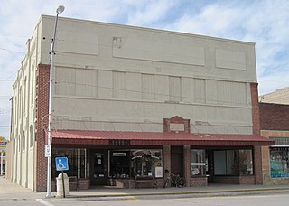
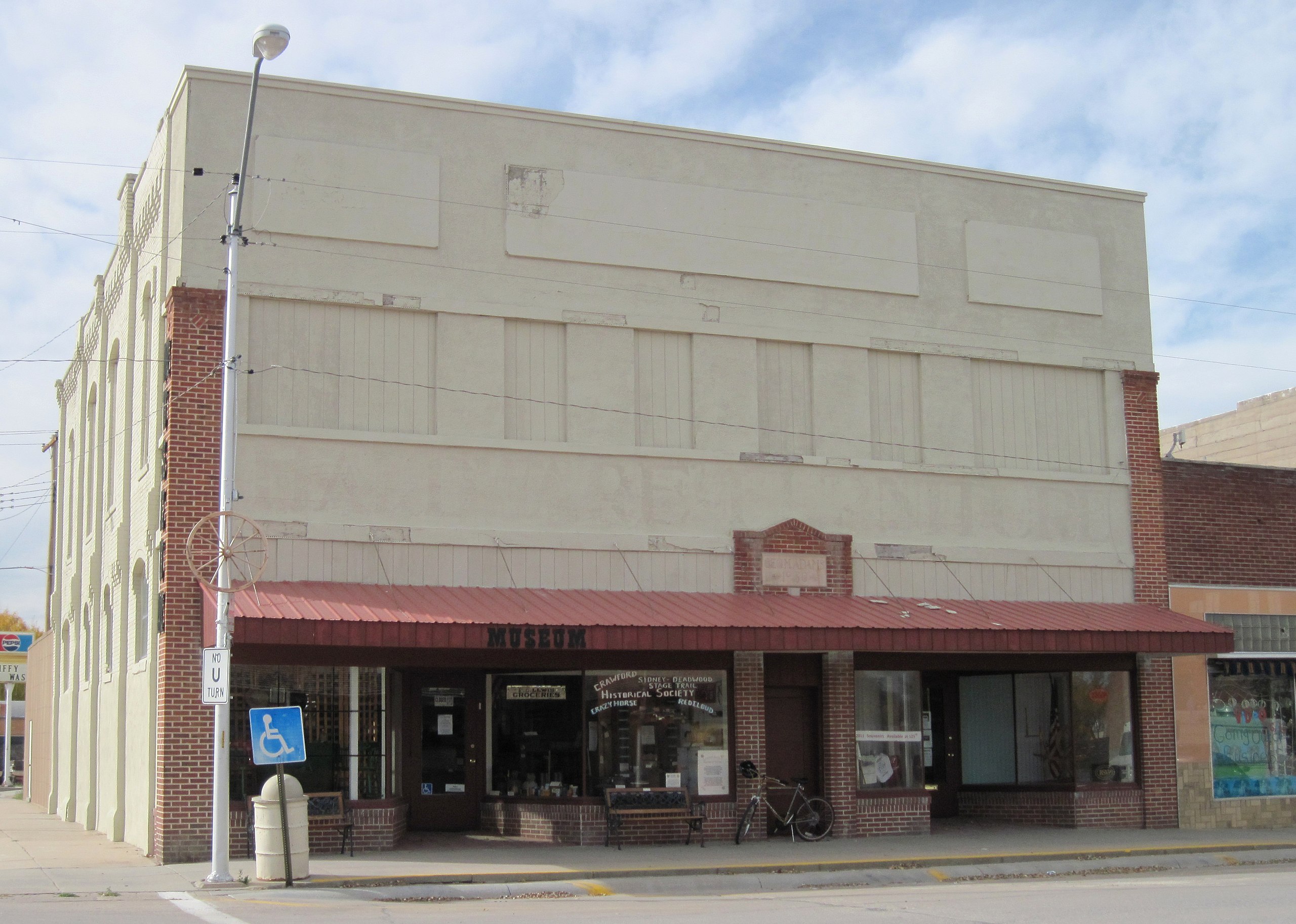
English: Exterior of the Adams Block in downtown Crawford, Nebraska. The edifice was built in 1887, making it the oldest brick structure and one of the oldest buildings in the city. The structure occupies two lots on the northwest corner of Second & Elm Streets. It was refronted in 1930, hence the problematic stucco. The brick on the side of the building is original, however.
The south (left) side of the building housed a hardware store for about 90 years and the north side housed a general merchandise establishment before becoming a furniture store. The upper story was used for offices and "gentlemen's entertainment". However, the upstairs was never updated for electricity or running water and was later used for storing the furniture store's surplus goods. The structure was purchased by the Crawford Cultural Center group in the 1970s. The north (right) side of the building was occupied by Crawford RSVP (which still uses the space, as of 2012), and the south side was used as the senior center before being utilized in 1991 as the Crawford Historical Museum (also still active), run by the Crawford Historical Society. Although the lower story has been kept up fairly well, the upstairs has fallen into a state of dilapidation due to neglect; however, the windows and access door have been closed up to prevent further damage. The additions on the rear of the building, constructed probably about 1910, are used for storage. Surprisingly, the structure does not have a basement. The Adams Block is now owned by the city, which is housed across the street behind the bank. Both organizations currently occupying the building remain active. |
| Date | |
| Source | Own work |
| Author | Chevsapher |
| Camera location | | View this and other nearby images on: OpenStreetMap |
|---|
.JPG¶ms=042.685833_N_-103.413333_E_globe:Earth_type:camera_region:US_&language=en)
Licensing
| This file is made available under the Creative Commons CC0 1.0 Universal Public Domain Dedication. | |
| The person who associated a work with this deed has dedicated the work to the public domain by waiving all of their rights to the work worldwide under copyright law, including all related and neighboring rights, to the extent allowed by law. You can copy, modify, distribute and perform the work, even for commercial purposes, all without asking permission.
|
| Annotations | This image is annotated: View the annotations at Commons |
File history
Click on a date/time to view the file as it appeared at that time.
| Date/Time | Thumbnail | Dimensions | User | Comment | |
|---|---|---|---|---|---|
| current | 20:17, 29 April 2012 | | 3,620 × 2,580 (1.74 MB) | Chevsapher |
File usage
The following 2 pages use this file:
Global file usage
The following other wikis use this file:
- Usage on en.wikipedia.org
- Usage on pt.wikivoyage.org
.JPG)