File:Antique World Map of Continents and Oceans 1700 (cropped).png
Size of this preview: 800 × 114 pixels. Other resolution: 1,600 × 228 pixels.
Original file (1,600 × 228 pixels, file size: 853 KB, MIME type: image/png)
This is a file from the Wikimedia Commons and may be used by other projects. Information from its description page there is shown below.
Commons is a freely licensed media file repository. |
Summary
| Description |
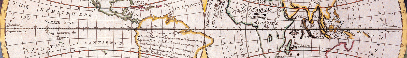
A NEW MAP of the TERRAQUEOUS GLOBE according to the Ancient Diſcoveries and moſt general Diviſions of it into CONTINENTS and OCEANS . Published in Oxford. Dedicated to Wiliam, Duke of Glouchester. Similar to National Library of Australia, NK 4620. Hand Colored. |
| Date | |
| Source | http://3.bp.blogspot.com/-jl_kxHuSRKE/UALCjdy2g5I/AAAAAAAABVI/FoMLzIXwZQs/s1600/AntiqueWorldMapContinentsandOceans1700-long+goodbye.png |
| Author | Made by English mathematician and clergyman Edward Wells (1667-1727). Engraver: Michael Burghers |
| Other versions |

.png)
Licensing
|
This work is in the public domain in its country of origin and other countries and areas where the copyright term is the author's life plus 100 years or fewer. | |
| This file has been identified as being free of known restrictions under copyright law, including all related and neighboring rights. | |
External links
File history
Click on a date/time to view the file as it appeared at that time.
| Date/Time | Thumbnail | Dimensions | User | Comment | |
|---|---|---|---|---|---|
| current | 18:50, 7 September 2019 | 1,600 × 228 (853 KB) | Traveler100 | File:Antique World Map of Continents and Oceans 1700.png cropped 81 % vertically using CropTool with precise mode. |
File usage
The following 2 pages use this file:
Global file usage
The following other wikis use this file:
- Usage on bn.wikivoyage.org
- Usage on incubator.wikimedia.org
- Usage on ja.wikivoyage.org
- Usage on shn.wikivoyage.org
- Usage on vi.wikivoyage.org
- Usage on www.wikidata.org
.png)