File:Bazaruto-Island-2009.jpg
Size of this preview: 800 × 477 pixels. Other resolutions: 320 × 191 pixels | 640 × 382 pixels | 1,024 × 611 pixels | 1,280 × 764 pixels | 2,560 × 1,527 pixels | 3,453 × 2,060 pixels.
Original file (3,453 × 2,060 pixels, file size: 3.34 MB, MIME type: image/jpeg)
This is a file from the Wikimedia Commons and may be used by other projects. Information from its description page there is shown below.
Commons is a freely licensed media file repository. |
Summary
| Description |
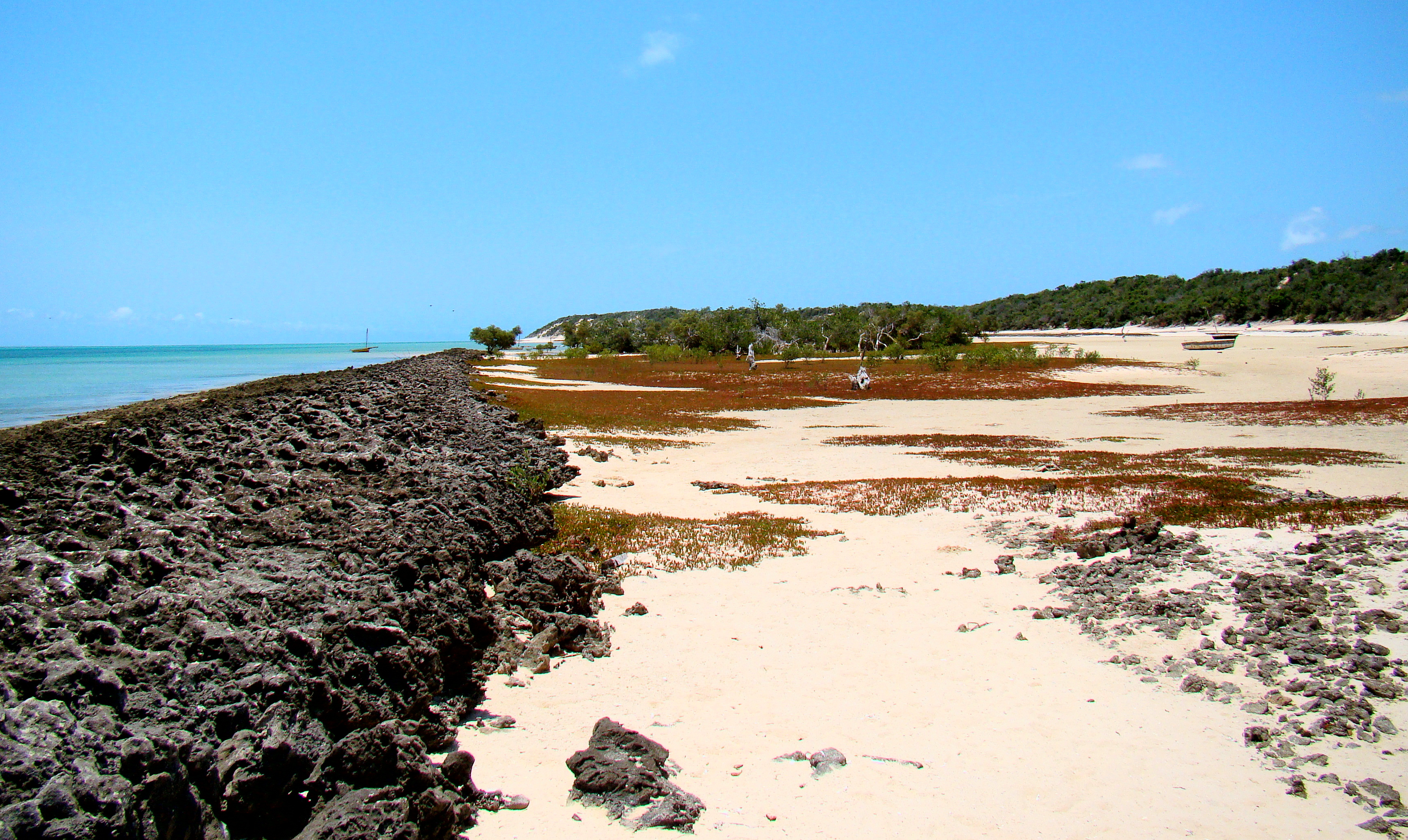
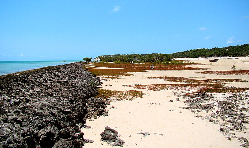
Afrikaans: 'n Klein baai, sowat 2 km van die suidpunt van Bazaruto-eiland, waar 'n ou koraalrif nou ontbloot word. Dit blokkeer sand sodat 'n jong manglietbos tans hier begin vestig.
English: A small bay, roughly 2 kilometres north of the southern end of Ilha Bazaruto. An old barrier reef has surfaced and trapped sand, building a place where a young mangrove forest can grow. |
| Date | |
| Source | Own work by uploader, http://bjornfree.com/galleries.html |
| Author | Bjørn Christian Tørrissen |
| Camera location | | View this and other nearby images on: OpenStreetMap |
|---|
Licensing
I, the copyright holder of this work, hereby publish it under the following licenses:
This file is licensed under the Creative Commons Attribution-Share Alike 3.0 Unported license.
- You are free:
- to share – to copy, distribute and transmit the work
- to remix – to adapt the work
- Under the following conditions:
- attribution – You must give appropriate credit, provide a link to the license, and indicate if changes were made. You may do so in any reasonable manner, but not in any way that suggests the licensor endorses you or your use.
- share alike – If you remix, transform, or build upon the material, you must distribute your contributions under the same or compatible license as the original.

|
Permission is granted to copy, distribute and/or modify this document under the terms of the GNU Free Documentation License, Version 1.2 or any later version published by the Free Software Foundation; with no Invariant Sections, no Front-Cover Texts, and no Back-Cover Texts. A copy of the license is included in the section entitled GNU Free Documentation License. |
You may select the license of your choice.
File history
Click on a date/time to view the file as it appeared at that time.
| Date/Time | Thumbnail | Dimensions | User | Comment | |
|---|---|---|---|---|---|
| current | 19:42, 21 March 2011 | | 3,453 × 2,060 (3.34 MB) | Uspn | {{Information |Description ={{en|1=A small bay, roughly 2 kilometres north of the southern end of Ilha Bazaruto. An old barrier reef has surfaced and trapped sand, building a place to grow for a young mangrove forest. }} |Source =Own work by up |
File usage
The following 2 pages use this file:
Global file usage
The following other wikis use this file:
- Usage on ca.wikipedia.org
- Usage on ceb.wikipedia.org
- Usage on el.wikipedia.org
- Usage on en.wikipedia.org
- Usage on es.wikipedia.org
- Usage on fr.wikivoyage.org
- Usage on ru.wikipedia.org
- Usage on ru.wikibooks.org
- Usage on www.wikidata.org
- Usage on zh.wikipedia.org