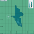
File:Bruce's Mark reef map.png

Size of this preview: 800 × 546 pixels. Other resolutions: 320 × 218 pixels | 640 × 437 pixels | 1,024 × 699 pixels | 1,280 × 874 pixels | 2,560 × 1,748 pixels | 8,779 × 5,994 pixels.
Original file (8,779 × 5,994 pixels, file size: 1.46 MB, MIME type: image/png)
File history
Click on a date/time to view the file as it appeared at that time.
| Date/Time | Thumbnail | Dimensions | User | Comment | |
|---|---|---|---|---|---|
| current | 11:16, 5 May 2024 |  | 8,779 × 5,994 (1.46 MB) | Pbsouthwood | added more 30m contour to north |
| 18:12, 11 November 2023 |  | 8,779 × 5,994 (1.42 MB) | Pbsouthwood | added more 30m contour at northwest | |
| 17:54, 10 August 2022 |  | 8,779 × 5,994 (1.38 MB) | Pbsouthwood | marks for the westerm pinnacle | |
| 19:11, 28 April 2022 |  | 5,851 × 5,994 (1.17 MB) | Pbsouthwood | added some 24m contours | |
| 10:36, 5 April 2022 |  | 5,851 × 5,994 (1.11 MB) | Pbsouthwood | added 21m contour | |
| 19:20, 14 November 2021 |  | 5,851 × 5,994 (1.02 MB) | Pbsouthwood | More 30m contour on west side | |
| 12:46, 30 August 2021 |  | 5,851 × 5,994 (994 KB) | Pbsouthwood | added partial 30m contour | |
| 18:34, 29 March 2021 |  | 4,866 × 4,214 (798 KB) | Pbsouthwood | Uploaded own work with UploadWizard |
File usage
The following page uses this file: