File:Kolkata transport map.svg

Size of this PNG preview of this SVG file: 397 × 600 pixels. Other resolutions: 159 × 240 pixels | 318 × 480 pixels | 508 × 768 pixels | 678 × 1,024 pixels | 1,356 × 2,048 pixels | 1,220 × 1,843 pixels.
Original file (SVG file, nominally 1,220 × 1,843 pixels, file size: 759 KB)
This is a file from the Wikimedia Commons and may be used by other projects. Information from its description page there is shown below.
Commons is a freely licensed media file repository. |

|
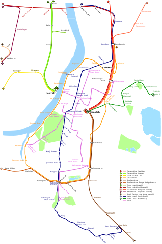
This file requires updating because: Howrah Maidan–Esplanade, Kavi Subhash–Hemanta Mukhopadhyay and Joka–Majerhat sections of the Kolkata Metro are now operational. In doing so, you could add a timestamp to the file.
|
Summary
| Description | |
| Date | |
| Source | Own work |
| Author | ArnabSaha |
Licensing
I, the copyright holder of this work, hereby publish it under the following license:
This file is licensed under the Creative Commons Attribution-Share Alike 4.0 International license.
- You are free:
- to share – to copy, distribute and transmit the work
- to remix – to adapt the work
- Under the following conditions:
- attribution – You must give appropriate credit, provide a link to the license, and indicate if changes were made. You may do so in any reasonable manner, but not in any way that suggests the licensor endorses you or your use.
- share alike – If you remix, transform, or build upon the material, you must distribute your contributions under the same or compatible license as the original.
File history
Click on a date/time to view the file as it appeared at that time.
| Date/Time | Thumbnail | Dimensions | User | Comment | |
|---|---|---|---|---|---|
| current | 20:43, 2 November 2022 | | 1,220 × 1,843 (759 KB) | ArnabSaha | Updated |
| 19:09, 15 September 2022 |  | 1,220 × 1,843 (186 KB) | ArnabSaha | Reverted to version as of 13:02, 12 August 2022 (UTC), wrong depiction of the map style | |
| 09:41, 31 August 2022 |  | 1,220 × 1,843 (232 KB) | Sbb1413 | Reverted to version as of 09:32, 17 July 2022 (UTC) please explain why the depiction was incorrect. It was an update to reflect that Sealdah metro station is operational. | |
| 13:02, 12 August 2022 |  | 1,220 × 1,843 (186 KB) | ArnabSaha | Reverted to version as of 06:14, 9 May 2021 (UTC) incorrect depiction. | |
| 09:32, 17 July 2022 |  | 1,220 × 1,843 (232 KB) | Sbb1413 | Extending line 2 to Sealdah as Sealdah starts metro operation. | |
| 06:14, 9 May 2021 |  | 1,220 × 1,843 (186 KB) | ArnabSaha | cleaned and optimised by User:Seloloving | |
| 19:39, 2 May 2021 |  | 1,220 × 1,843 (779 KB) | Eviolite | removed reference image layer | |
| 19:12, 2 May 2021 |  | 1,220 × 1,843 (2.32 MB) | ArnabSaha | Correction | |
| 13:14, 22 April 2021 |  | 1,220 × 1,843 (2.31 MB) | ArnabSaha | Updated | |
| 19:01, 4 May 2020 |  | 1,220 × 1,724 (2.28 MB) | ArnabSaha | Uploaded own work with UploadWizard |
File usage
The following page uses this file:
Global file usage
The following other wikis use this file:
- Usage on bn.wikipedia.org
- Usage on bn.wikivoyage.org
- Usage on en.wikipedia.org
- Usage on eo.wikipedia.org
- Usage on fa.wikipedia.org
- Usage on hi.wikipedia.org
- Usage on id.wikipedia.org
- Usage on ja.wikipedia.org
- Usage on ru.wikipedia.org
- Usage on zh.wikipedia.org