File:Kusatsu-Shiranesan01s5s4272.jpg
Size of this preview: 800 × 533 pixels. Other resolutions: 320 × 213 pixels | 640 × 427 pixels | 1,024 × 683 pixels | 1,280 × 853 pixels | 2,560 × 1,707 pixels | 4,272 × 2,848 pixels.
Original file (4,272 × 2,848 pixels, file size: 3.86 MB, MIME type: image/jpeg)
This is a file from the Wikimedia Commons and may be used by other projects. Information from its description page there is shown below.
Commons is a freely licensed media file repository. |
| Description |
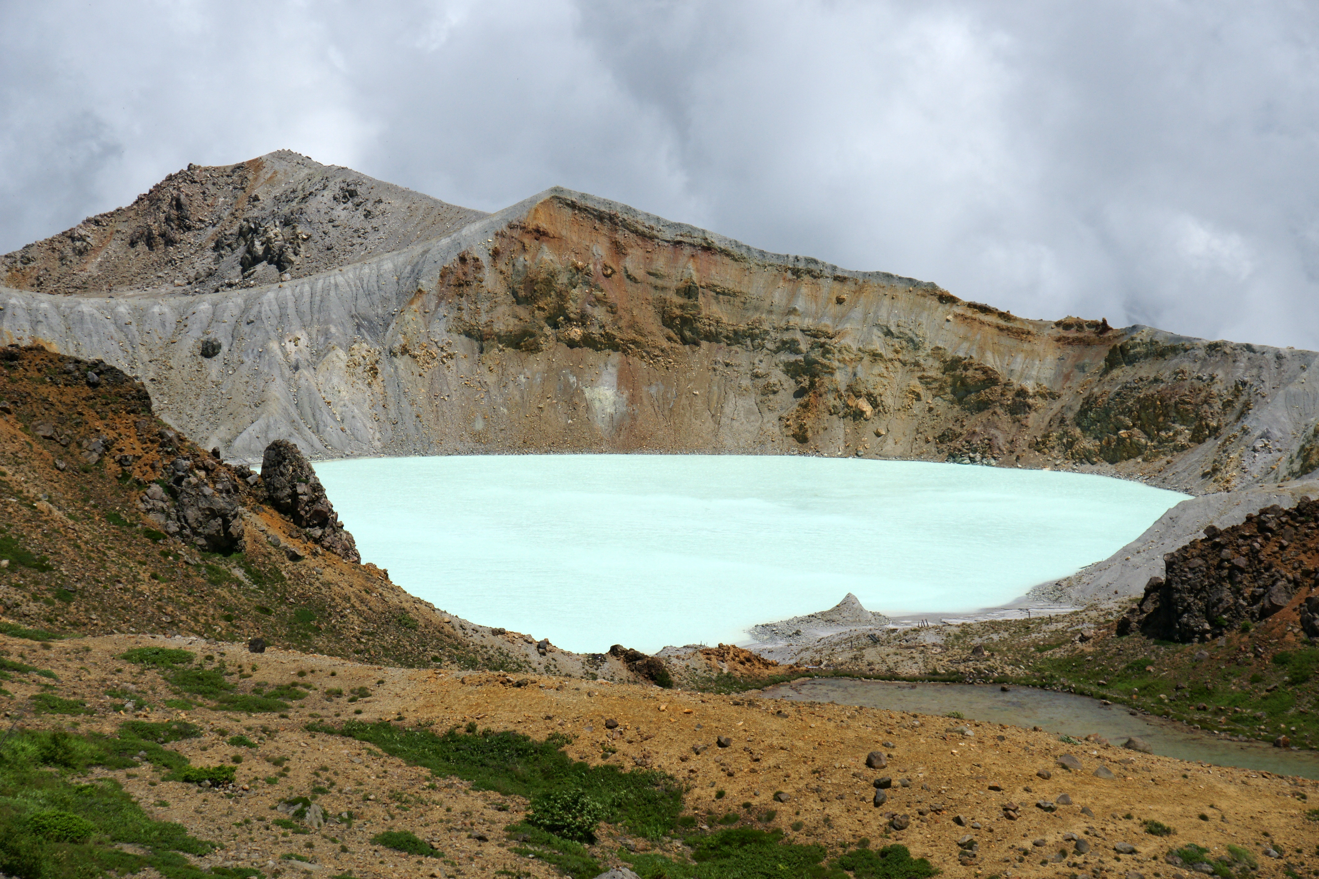
English: Mount Kusatsu-Shirane, Kusatsu, Gunma prefecture, Japan
Camera: Sony DSLR-A700Lens: Sony SAL16105 |
| Date | |
| Source | Own work |
| Author | 663highland |
| Camera location | | View this and other nearby images on: OpenStreetMap |
|---|
English: This image was selected as a picture of the month on the Japanese language Wikipedia and is considered one of the finest images. Svenska: Denna bild valdes som månadens bild på japanskspråkiga Wikipedia och anses vara en av de finaste bilderna. Українська: Це зображення було зображенням місяця в японській Вікіпедії і вважається одним з найкращих зображень. 日本語: これは日本語版ウィキペディアにおける月間新記事賞 今月の一枚に選ばれた画像であり、最も優れた画像の一つであると評価されました。 |
|
I, the copyright holder of this work, hereby publish it under the following licenses:

|
Permission is granted to copy, distribute and/or modify this document under the terms of the GNU Free Documentation License, Version 1.2 or any later version published by the Free Software Foundation; with no Invariant Sections, no Front-Cover Texts, and no Back-Cover Texts. A copy of the license is included in the section entitled GNU Free Documentation License. |
| This file is licensed under the Creative Commons Attribution-Share Alike 3.0 Unported license. | ||
| ||
| This licensing tag was added to this file as part of the GFDL licensing update. |
This file is licensed under the Creative Commons Attribution 2.5 Generic license.
- You are free:
- to share – to copy, distribute and transmit the work
- to remix – to adapt the work
- Under the following conditions:
- attribution – You must give appropriate credit, provide a link to the license, and indicate if changes were made. You may do so in any reasonable manner, but not in any way that suggests the licensor endorses you or your use.
You may select the license of your choice.
File history
Click on a date/time to view the file as it appeared at that time.
| Date/Time | Thumbnail | Dimensions | User | Comment | |
|---|---|---|---|---|---|
| current | 22:55, 28 July 2009 | | 4,272 × 2,848 (3.86 MB) | 663highland | {{Information |Description={{en|'''Mount Kusatsu-Shirane''', Kusatsu, Gunma prefecture, Japan}} {{ja|'''草津白根山の湯釜''', 群馬県草津町}} |Source=[[:ja:user:663highland|663hig |
File usage
The following page uses this file:
Global file usage
The following other wikis use this file:
- Usage on ar.wikipedia.org
- Usage on cs.wikipedia.org
- Usage on de.wikipedia.org
- Usage on en.wikipedia.org
- Usage on es.wikipedia.org
- Usage on fi.wikipedia.org
- Usage on fr.wikipedia.org
- Usage on fr.wikivoyage.org
- Usage on it.wikipedia.org
- Usage on ja.wikipedia.org
- 湖沼
- 日本百名山
- 万座温泉
- Wikipedia:おすすめ画像
- 利用者‐会話:663highland
- 草津白根山
- 利用者:663highland/投稿画像ギャラリー・関東地方
- 火口
- Portal:日本の都道府県/群馬県
- 上信越高原国立公園
- Portal:日本の都道府県/群馬県/新着画像
- Wikipedia:秀逸な画像
- Wikipedia:秀逸な画像, リスト
- Wikipedia:秀逸な画像/自然風景
- Wikipedia:月間新記事賞/2009年8月
- Wikipedia:秀逸な画像の推薦/ファイル:Kusatsu-Shiranesan01s5s4272.jpg
- 群馬県
- Wikipedia:秀逸な画像の推薦/記録/2009年12月
- Wikipedia:今日の一枚/2013年3月
- Wikipedia:今日の一枚/2013年11月
- Wikipedia:今日の一枚の推薦/ファイル:Kusatsu-Shiranesan01s5s4272.jpg
- Template:POTD/2013-03-24
- Template:POTD/2013-11-18
- 群馬県の観光地
- Wikipedia:秀逸な画像の推薦/ファイル:Kusatsu-Shiranesan01s5s4272.jpg-2
- Wikipedia:秀逸な画像の推薦/記録/2017年4月
- Wikipedia:秀逸な画像/年月別画像集/2017年4月
- Wikipedia:今日の一枚/Kusatsu-Shiranesan01s5s4272.jpg
- Usage on ja.wikivoyage.org
- Usage on ko.wikipedia.org
- Usage on ru.wikipedia.org
- Usage on sk.wikipedia.org
- Usage on zh.wikipedia.org