File:Map of Sweden Cities (polar stereographic).svg

Size of this PNG preview of this SVG file: 251 × 599 pixels. Other resolutions: 100 × 240 pixels | 201 × 480 pixels | 321 × 768 pixels | 429 × 1,024 pixels | 858 × 2,048 pixels | 1,000 × 2,387 pixels.
Original file (SVG file, nominally 1,000 × 2,387 pixels, file size: 694 KB)
This is a file from the Wikimedia Commons and may be used by other projects. Information from its description page there is shown below.
Commons is a freely licensed media file repository. |
Summary
| Description |
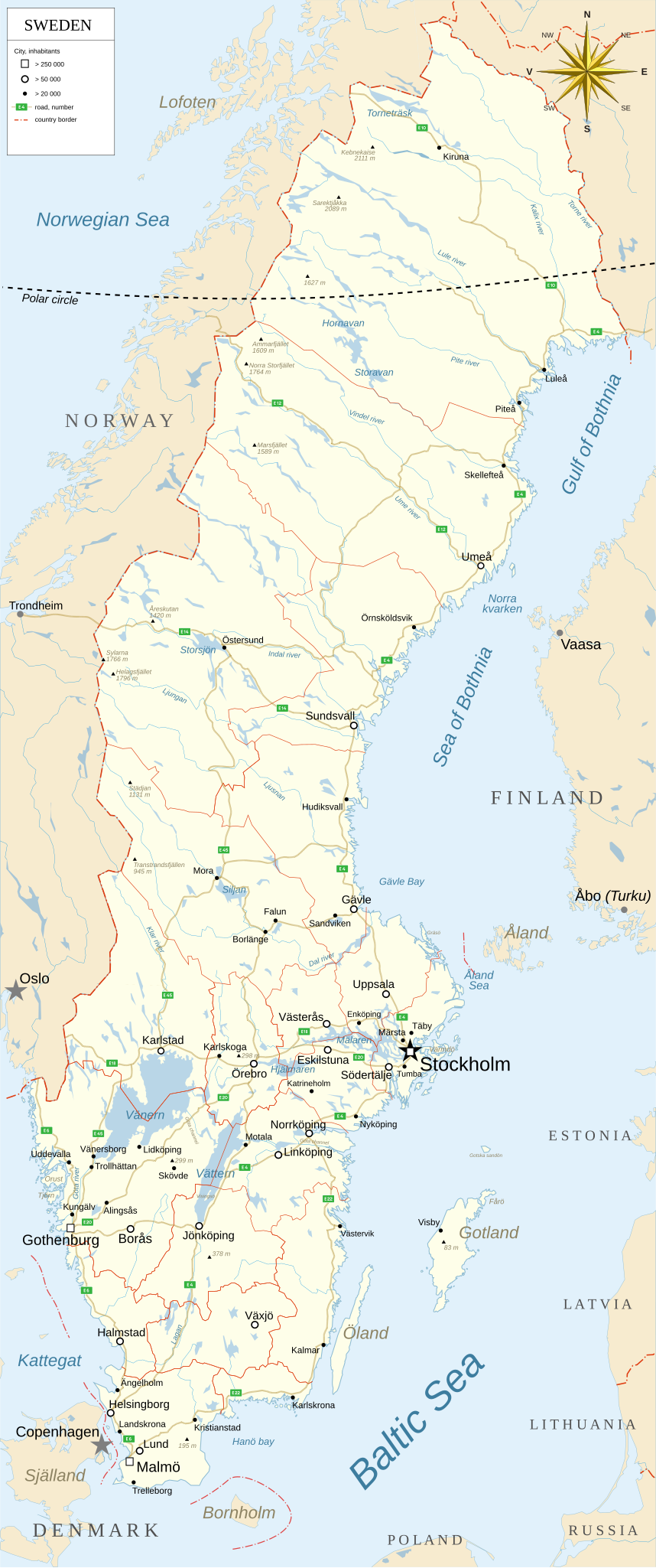
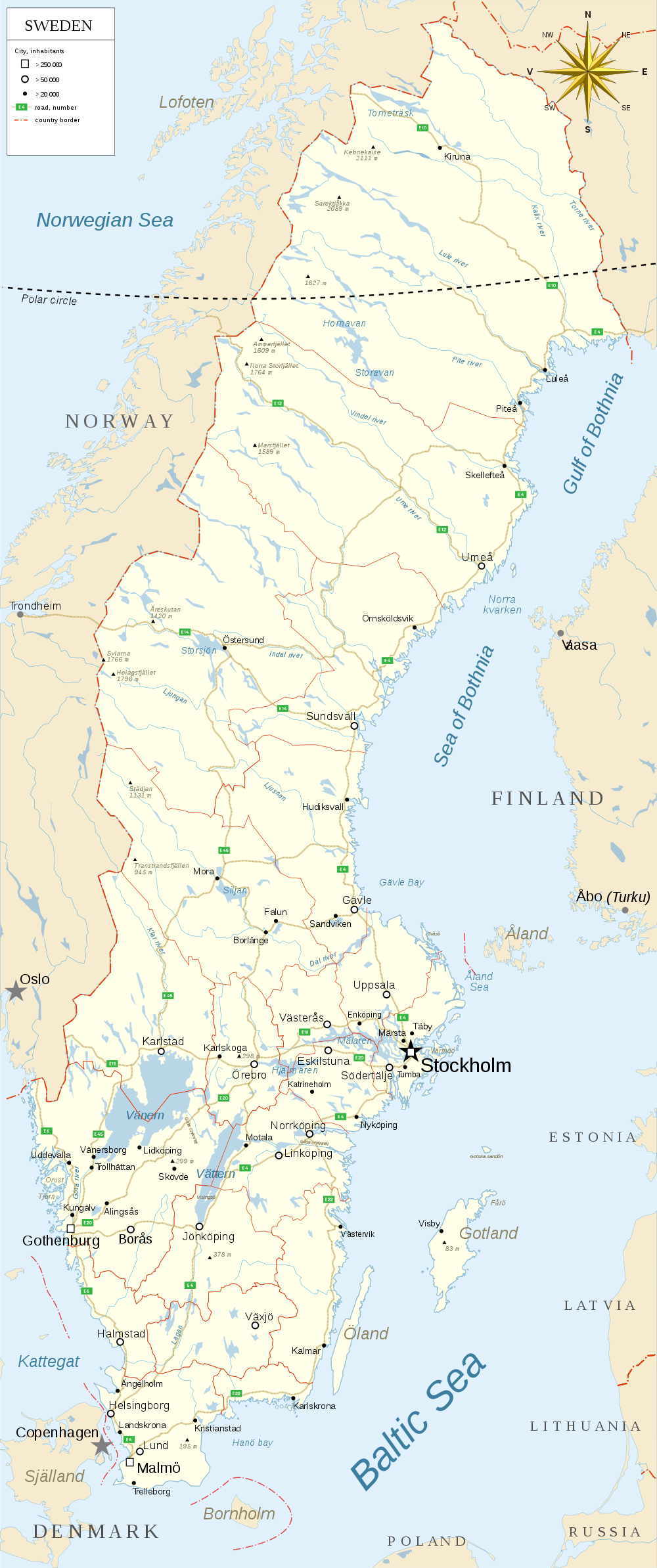
English: Map of Sweden with cities and country borders.
Svenska: Karta över Sverige med städer och riksgränser. |
| Date | |
| Source | Own work by uploader + Online Map Creation, http://www.aquarius.ifm-geomar.de/ |
| Author | Koyos |
| Other versions |
Derivative works of this file:
|
.png)

_Sv.svg)
_Sv.png)
_mk.svg)
.svg)
Licensing
| I, the copyright holder of this work, release this work into the public domain. This applies worldwide. In some countries this may not be legally possible; if so: I grant anyone the right to use this work for any purpose, without any conditions, unless such conditions are required by law. |
File history
Click on a date/time to view the file as it appeared at that time.
| Date/Time | Thumbnail | Dimensions | User | Comment | |
|---|---|---|---|---|---|
| current | 18:40, 15 June 2009 | | 1,000 × 2,387 (694 KB) | Koyos | spelling |
| 18:13, 15 June 2009 |  | 1,000 × 2,387 (694 KB) | Koyos | improved | |
| 20:44, 1 May 2009 | 538 × 1,300 (450 KB) | Koyos | ! | ||
| 20:42, 1 May 2009 | 538 × 1,300 (449 KB) | Koyos | fix | ||
| 20:40, 1 May 2009 | 365 × 882 (445 KB) | Koyos | better? | ||
| 20:28, 1 May 2009 | 365 × 882 (465 KB) | Koyos | fix | ||
| 20:21, 1 May 2009 | 365 × 882 (471 KB) | Koyos | {{Information |Description={{en|1=gh}} |Source=Own work by uploader |Author=Koyos |Date= |Permission= |other_versions= }} <!--{{ImageUpload|full}}--> |
File usage
There are no pages that use this file.
Global file usage
The following other wikis use this file:
- Usage on de.wikipedia.org
- Usage on el.wikipedia.org
- Usage on ka.wikipedia.org
.svg)