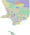
File:Mapping L.A. neighborhood boundaries.svg

Size of this PNG preview of this SVG file: 419 × 491 pixels. Other resolutions: 205 × 240 pixels | 410 × 480 pixels | 655 × 768 pixels | 874 × 1,024 pixels | 1,748 × 2,048 pixels.
Original file (SVG file, nominally 419 × 491 pixels, file size: 944 KB)
File history
Click on a date/time to view the file as it appeared at that time.
| Date/Time | Thumbnail | Dimensions | User | Comment | |
|---|---|---|---|---|---|
| current | 18:04, 3 August 2021 |  | 419 × 491 (944 KB) | Dpavelko | Reverted to version as of 05:08, 29 May 2013 (UTC) - text didn't render properly |
| 17:55, 3 August 2021 |  | 419 × 491 (831 KB) | Dpavelko | Corrected second neighborhood named Sylmar to be Sherman Oaks | |
| 05:08, 29 May 2013 |  | 419 × 491 (944 KB) | Peterfitzgerald | turning on the names layers, just so people know they exist | |
| 04:44, 17 May 2013 |  | 419 × 491 (944 KB) | Peterfitzgerald | +neighborhood names (in hidden layers) | |
| 03:18, 17 May 2013 |  | 419 × 491 (734 KB) | Peterfitzgerald | Sorting neighborhoods into layers per the Mapping L.A. Regions | |
| 02:31, 17 May 2013 |  | 419 × 491 (728 KB) | Peterfitzgerald | just a little bit of cleaning up extraneous gunk | |
| 02:29, 17 May 2013 |  | 419 × 491 (794 KB) | Peterfitzgerald | color defining neighborhood objects | |
| 23:04, 16 May 2013 |  | 419 × 491 (767 KB) | Peterfitzgerald | {{Information |Description ={{en|1=All L.A. County neighborhoods as defined by [http://projects.latimes.com/mapping-la/neighborhoods/ Mapping L.A.] in SVG form, intended for derivative works.}} |Source =[http://projects.latimes.com/mapping-l... |
File usage
The following page uses this file:
Global file usage
The following other wikis use this file:
- Usage on fa.wikipedia.org
- Usage on www.wikidata.org