File:Palmyra NY - Aldrich Change Bridge.jpg
Original file (2,304 × 1,206 pixels, file size: 1.3 MB, MIME type: image/jpeg)
This is a file from the Wikimedia Commons and may be used by other projects. Information from its description page there is shown below.
Commons is a freely licensed media file repository. |
Summary
| Description |
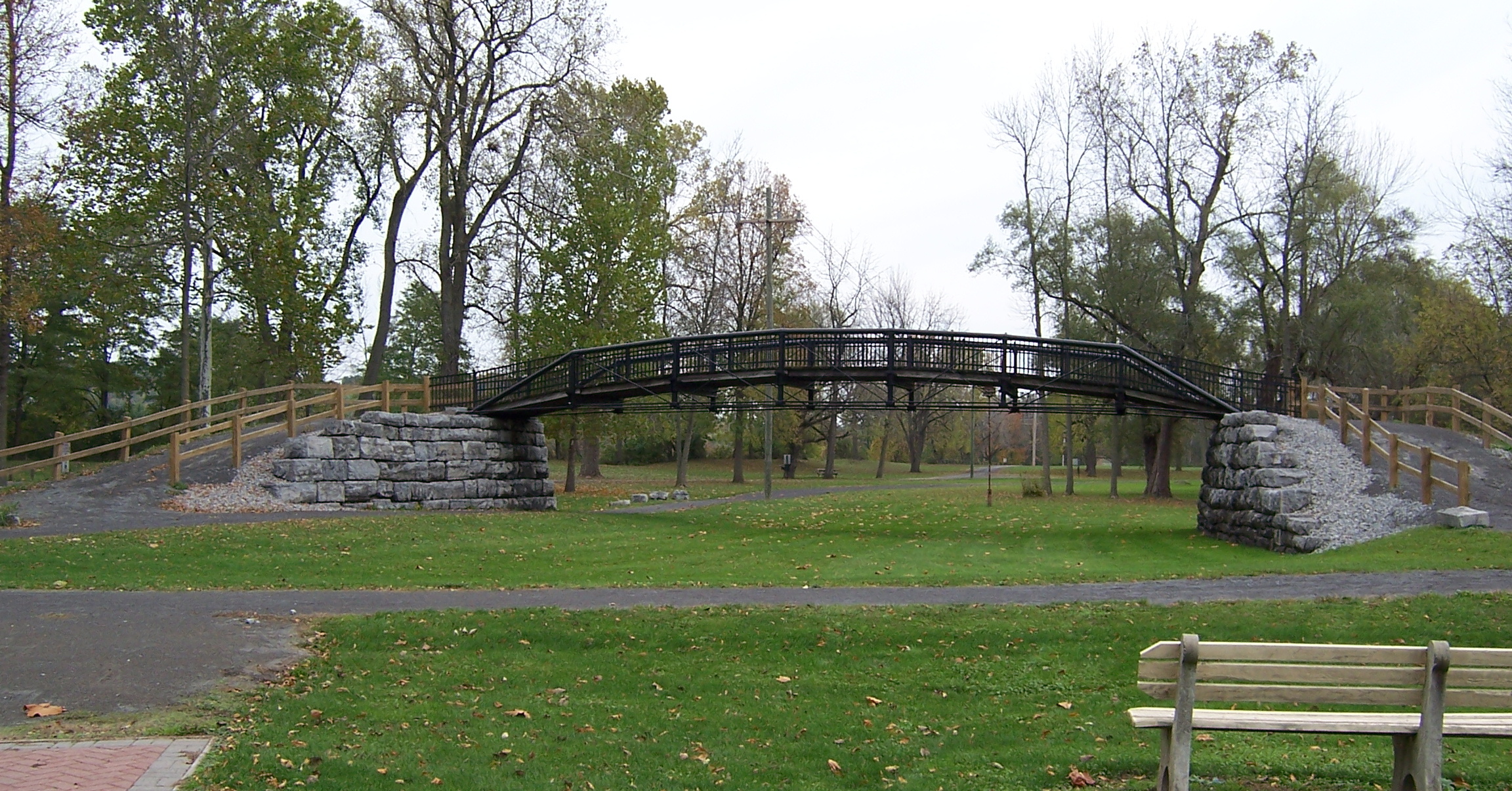
English: The Aldrich Change Bridge in Aqueduct Park in en:Palmyra, New York.
The bridge was originally built to carry the Erie Canal towpath over a canal weighlock in w:Rochester, New York. It was removed and put into storage in 1879. But in 1880, the wooden change bridge in Palmyra (when the Canal was widened early in its history, there was no room for the south-side towpath through the village, so this bridge was needed to move the towpath to the north side of the canal) collapsed. One span of the Rochester weighlock change bridge was pulled out of storage, shortened, and pressed into service in Palmyra, where it became known as the Aldrich Change Bridge. When the Barge Canal bypassed the old routing through Palmyra, the change bridge became superfluous. It was purchased by a farmer who used it to bridge Ganargua Creek to access his land. Abandoned in the 1970s or 80s, it was knocked off of its abutments in 1996 by a high icy creek. The Town of Macedon acquired it and moved it to Aqueduct Park in 1998. |
| Date | |
| Source | Own work |
| Author | LtPowers |
| Camera location | | View this and other nearby images on: OpenStreetMap |
|---|
Licensing
- You are free:
- to share – to copy, distribute and transmit the work
- to remix – to adapt the work
- Under the following conditions:
- attribution – You must give appropriate credit, provide a link to the license, and indicate if changes were made. You may do so in any reasonable manner, but not in any way that suggests the licensor endorses you or your use.
- share alike – If you remix, transform, or build upon the material, you must distribute your contributions under the same or compatible license as the original.
File history
Click on a date/time to view the file as it appeared at that time.
| Date/Time | Thumbnail | Dimensions | User | Comment | |
|---|---|---|---|---|---|
| current | 02:07, 28 October 2014 | | 2,304 × 1,206 (1.3 MB) | LtPowers | User created page with UploadWizard |
File usage
The following page uses this file: