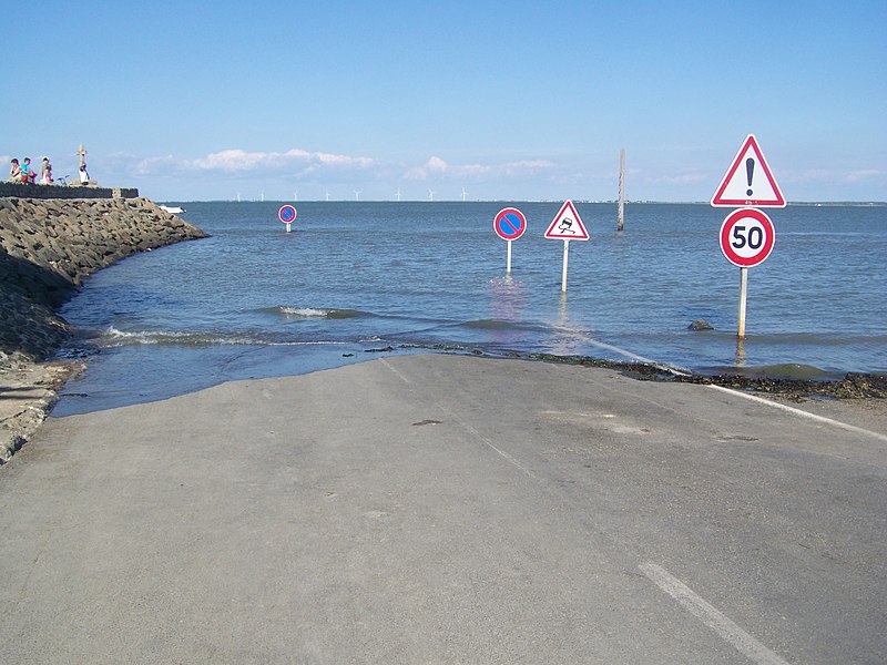
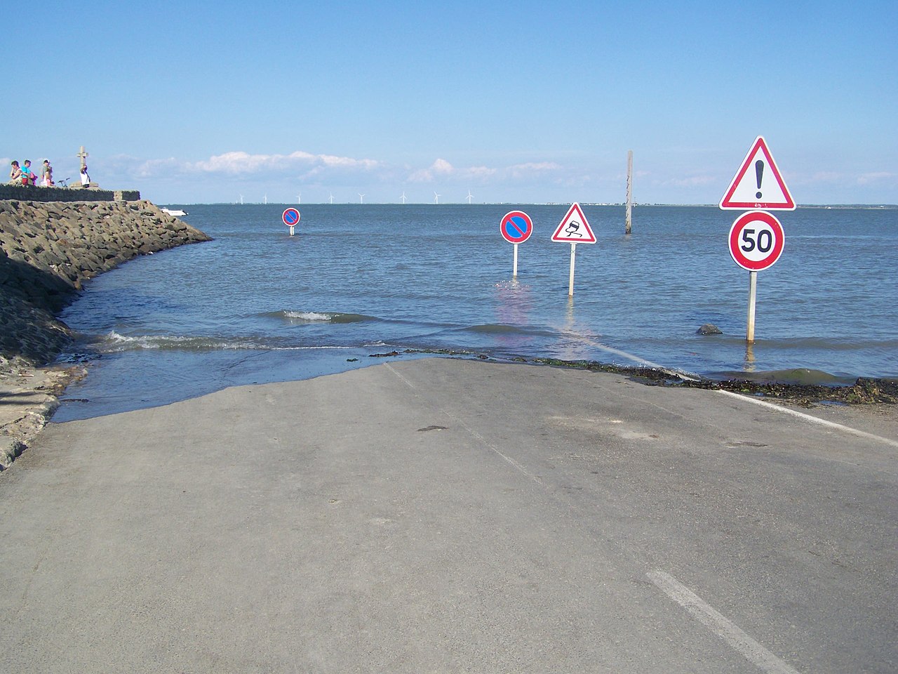
File:Passage du Gois immergé.JPG

Size of this preview: 800 × 600 pixels. Other resolutions: 320 × 240 pixels | 640 × 480 pixels | 1,024 × 768 pixels | 1,280 × 960 pixels | 2,048 × 1,536 pixels.
Original file (2,048 × 1,536 pixels, file size: 659 KB, MIME type: image/jpeg)
This is a file from the Wikimedia Commons and may be used by other projects. Information from its description page there is shown below.
Commons is a freely licensed media file repository. |
Summary
| Description | |
| Date | |
| Source | Own work |
| Author | Florian Pépellin |
| Permission (Reusing this file) |
CC-BY-SA 3.0 |
| Camera location | | View this and other nearby images on: OpenStreetMap |
|---|

|
This image has been assessed under the valued image criteria and is considered the most valued image on Commons within the scope: Submerged Passage du Gois (Passage du Gois submergé). You can see its nomination here. |
Licensing
I, the copyright holder of this work, hereby publish it under the following license:
This file is licensed under the Creative Commons Attribution-Share Alike 3.0 Unported, 2.5 Generic, 2.0 Generic and 1.0 Generic license.
- You are free:
- to share – to copy, distribute and transmit the work
- to remix – to adapt the work
- Under the following conditions:
- attribution – You must give appropriate credit, provide a link to the license, and indicate if changes were made. You may do so in any reasonable manner, but not in any way that suggests the licensor endorses you or your use.
- share alike – If you remix, transform, or build upon the material, you must distribute your contributions under the same or compatible license as the original.
File history
Click on a date/time to view the file as it appeared at that time.
| Date/Time | Thumbnail | Dimensions | User | Comment | |
|---|---|---|---|---|---|
| current | 15:29, 4 January 2011 | | 2,048 × 1,536 (659 KB) | Floflo | {{Information |Description={{en|1=Sight at high tide of the ''passage du Gois'', joining France to ''île de Noirmoutier'' in Vendée, and passable only at low tide.}} {{fr|1=Vue à marée haute du ''passage du Gois'' reliant la France à l''' |
File usage
The following page uses this file:
Global file usage
The following other wikis use this file:
- Usage on en.wikipedia.org
- Usage on fr.wikipedia.org
- Usage on te.wikipedia.org
- Usage on vi.wikipedia.org