File:Pukaskwa National Park.jpg
Size of this preview: 426 × 599 pixels. Other resolutions: 170 × 240 pixels | 341 × 480 pixels | 728 × 1,024 pixels.
Original file (728 × 1,024 pixels, file size: 586 KB, MIME type: image/jpeg)
This is a file from the Wikimedia Commons and may be used by other projects. Information from its description page there is shown below.
Commons is a freely licensed media file repository. |
Summary
| Description |
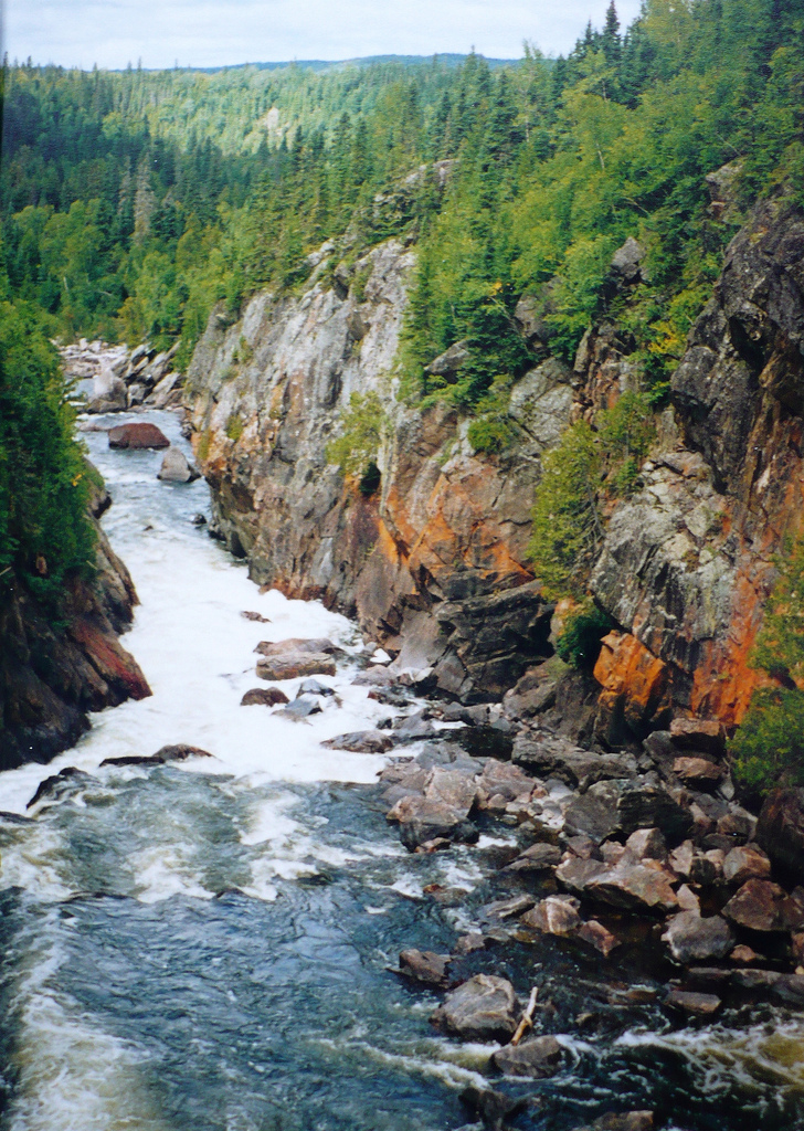
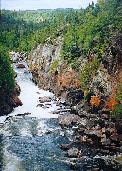
English: Pukaskwa National Park, Ontario, Canada
Deutsch: Pukaskwa-Nationalpark: Blick von der White River Suspension Bridge auf den Fluss |
| Date | |
| Source | Own work |
| Author | Paul Gierszewski |
| Camera location | | View this and other nearby images on: OpenStreetMap |
|---|
Licensing
| I, the copyright holder of this work, release this work into the public domain. This applies worldwide. In some countries this may not be legally possible; if so: I grant anyone the right to use this work for any purpose, without any conditions, unless such conditions are required by law. |
File history
Click on a date/time to view the file as it appeared at that time.
| Date/Time | Thumbnail | Dimensions | User | Comment | |
|---|---|---|---|---|---|
| current | 02:30, 11 January 2010 | | 728 × 1,024 (586 KB) | Gierszep | {{Information |Description={{en|1=Pukaskwa National Park, Ontario, Canada}} |Source={{own}} |Author=Gierszep |Date=1998 |Permission= |other_versions= }} Category:Puskakwa National Park |
File usage
The following 2 pages use this file:
Global file usage
The following other wikis use this file:
- Usage on bg.wikipedia.org
- Usage on ceb.wikipedia.org
- Usage on de.wikipedia.org
- Usage on en.wikipedia.org
- Usage on fr.wikivoyage.org
- Usage on ka.wikipedia.org
- Usage on ru.wikipedia.org
- Usage on uk.wikipedia.org
- Usage on vls.wikipedia.org
- Usage on www.wikidata.org