File:Ranipuram.jpg

Size of this preview: 799 × 599 pixels. Other resolutions: 320 × 240 pixels | 640 × 480 pixels | 909 × 682 pixels.
Original file (909 × 682 pixels, file size: 29 KB, MIME type: image/jpeg)
This is a file from the Wikimedia Commons and may be used by other projects. Information from its description page there is shown below.
Commons is a freely licensed media file repository. |
Summary
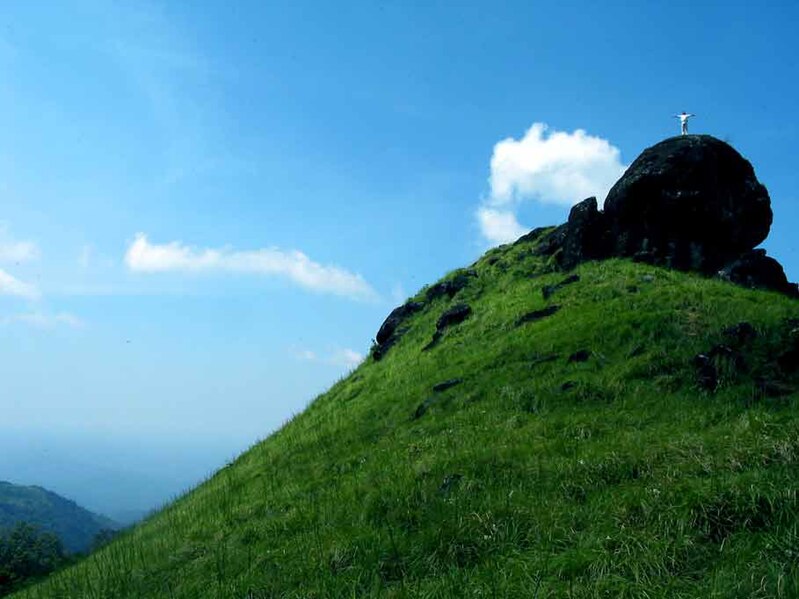
| Description | Ranipuram is around 60km from KASARAGOD.Abeautiful destination for nature lovers. |
| Date | |
| Source | RANIPURAM |
| Author | Bibu Raj from THRISSUR, INDIA |
| Camera location | | View this and other nearby images on: OpenStreetMap |
|---|
Licensing
This file is licensed under the Creative Commons Attribution 2.0 Generic license.
- You are free:
- to share – to copy, distribute and transmit the work
- to remix – to adapt the work
- Under the following conditions:
- attribution – You must give appropriate credit, provide a link to the license, and indicate if changes were made. You may do so in any reasonable manner, but not in any way that suggests the licensor endorses you or your use.
| This image was originally posted to Flickr by BIBZFOTO at https://www.flickr.com/photos/10083149@N00/278188660. It was reviewed on 13 December 2007 by FlickreviewR and was confirmed to be licensed under the terms of the cc-by-2.0. |
File history
Click on a date/time to view the file as it appeared at that time.
| Date/Time | Thumbnail | Dimensions | User | Comment | |
|---|---|---|---|---|---|
| current | 19:35, 12 December 2007 | | 909 × 682 (29 KB) | Anoopkn | {{Information |Description= Ranipuram is around 60km from KASARAGOD.Abeautiful destination for nature lovers. |Source=[http://www.flickr.com/photos/10083149@N00/278188660/ RANIPURAM] |Date=October 24, 2006 at 17:22 |Author=[http://www.flickr.com/people/10 |
File usage
The following page uses this file:
Global file usage
The following other wikis use this file:
- Usage on arz.wikipedia.org
- Usage on bn.wikipedia.org
- Usage on en.wikipedia.org
- Usage on sa.wikipedia.org
- Usage on ta.wikipedia.org
- Usage on te.wikipedia.org
- Usage on www.wikidata.org