File:Rockaway Beach aerial view.jpg
Size of this preview: 800 × 534 pixels. Other resolutions: 320 × 214 pixels | 640 × 428 pixels | 1,024 × 684 pixels | 1,500 × 1,002 pixels.
Original file (1,500 × 1,002 pixels, file size: 536 KB, MIME type: image/jpeg)
This is a file from the Wikimedia Commons and may be used by other projects. Information from its description page there is shown below.
Commons is a freely licensed media file repository. |
| Description |
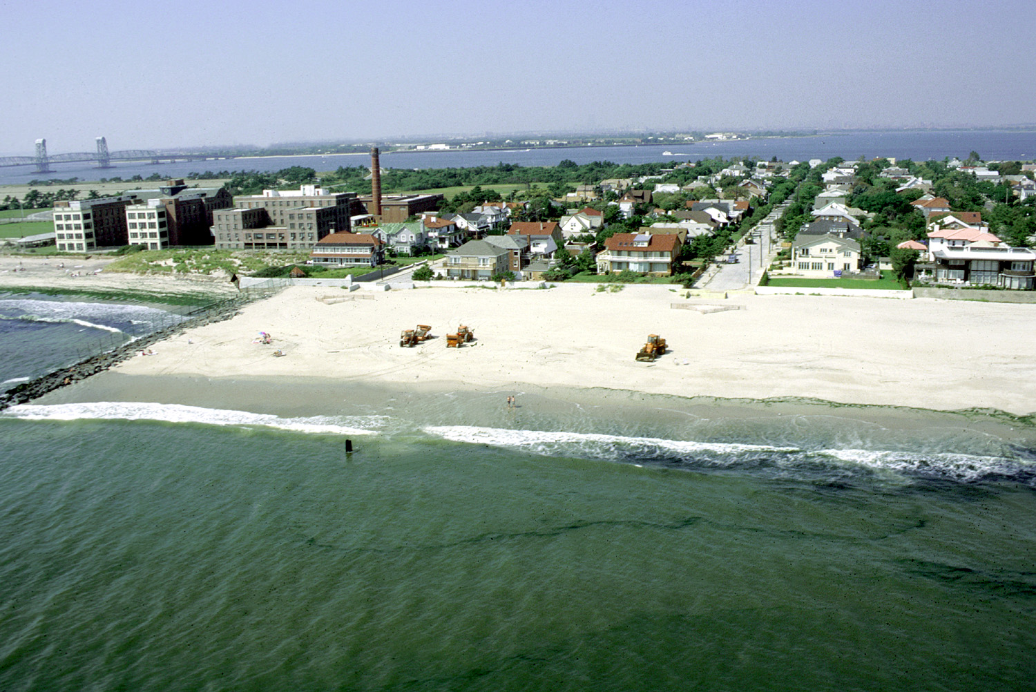
English: Aerial view of the beach area of Rockaway Park neighborhood, Queens, New York. The photograph appears to be taken from directly off the end of Beach 148th Street in the Neponsit area, next to Jacob Riis Park. The U.S. Army Corps of Engineers is working to replenish the sand on the beach. en:Marine Parkway-Gil Hodges Memorial Bridge in background left. |
|||
| Date | ||||
| Source |
U.S. Army Corps of Engineers Digital Visual Library Image page Image description page Digital Visual Library home page |
|||
| Author | Peter Shugert, U.S. Army Corps of Engineers | |||
| Permission (Reusing this file) |
|
|||
| Location | Queens, New York City, New York, USA |
| Object location | | View this and other nearby images on: OpenStreetMap |
|---|
File history
Click on a date/time to view the file as it appeared at that time.
| Date/Time | Thumbnail | Dimensions | User | Comment | |
|---|---|---|---|---|---|
| current | 03:49, 9 April 2007 | | 1,500 × 1,002 (536 KB) | DanMS | {{Information | Description = {{en|Aerial view of the beach area of Rockaway Park neighborhood, Queens, New York. The photograph appears to be taken from directly off the end of Beach 148th Street in the Neponsit area, next to Jacob Riis Park. The U.S. |
File usage
The following page uses this file:
Global file usage
The following other wikis use this file:
- Usage on azb.wikipedia.org
- Usage on de.wikipedia.org
- Usage on en.wikipedia.org
- Usage on www.wikidata.org
- Q62146
- Wikidata:Translatathon NYC/es
- Wikidata:Translatathon NYC/zh
- Wikidata:Translatathon NYC/ru
- Wikidata:Translatathon NYC/ro
- Wikidata:Translatathon NYC/el
- Wikidata:Translatathon NYC/de
- Wikidata:Translatathon NYC/fr
- Wikidata:Translatathon NYC/my
- Wikidata:Translatathon NYC/ar
- Wikidata:Translatathon NYC/bn
- Wikidata:Translatathon NYC/hi
- Wikidata:Translatathon NYC/jp
- Wikidata:Translatathon NYC/ko
- Wikidata:Translatathon NYC/pt
- Wikidata:Translatathon NYC/ht
- Wikidata:Translatathon NYC/uk
- Wikidata:Translatathon NYC/tl
- Wikidata:Translatathon NYC/yi
- Wikidata:Translatathon NYC/ka