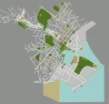
File:Singapore.svg

Size of this PNG preview of this SVG file: 631 × 599 pixels. Other resolutions: 253 × 240 pixels | 505 × 480 pixels | 809 × 768 pixels | 1,078 × 1,024 pixels | 2,156 × 2,048 pixels | 2,129 × 2,022 pixels.
Original file (SVG file, nominally 2,129 × 2,022 pixels, file size: 2.53 MB)
File history
Click on a date/time to view the file as it appeared at that time.
| Date/Time | Thumbnail | Dimensions | User | Comment | |
|---|---|---|---|---|---|
| current | 12:58, 30 January 2018 |  | 2,129 × 2,022 (2.53 MB) | Drat70 | Updated Marina Bay area |
| 12:13, 20 November 2017 |  | 2,129 × 2,022 (2.53 MB) | Drat70 | Updated Orchard area | |
| 12:59, 15 November 2017 |  | 2,129 × 2,022 (2.5 MB) | Drat70 | Updated Brash Basah area | |
| 13:36, 23 October 2017 |  | 2,129 × 2,022 (2.47 MB) | Drat70 | Updated listings/map for Riverside | |
| 14:09, 20 October 2017 |  | 2,129 × 2,022 (2.47 MB) | Drat70 | Updated Clarke Quay area | |
| 12:26, 16 October 2017 |  | 2,129 × 2,022 (2.47 MB) | Drat70 | Updated Chinatown | |
| 12:08, 9 October 2017 |  | 2,129 × 2,022 (2.46 MB) | Drat70 | Updated places and roads in Little India area | |
| 12:35, 2 October 2017 |  | 2,129 × 2,022 (2.43 MB) | Drat70 | Extended map into Marina Bay area added layer for Marina Bay area added remaining stations for Downtown line | |
| 06:21, 21 September 2017 |  | 744 × 1,052 (1.36 MB) | Drat70 | General update, mostly in the Bugis area: * removed/added buildings and roads which are not up to date * added Downtown line stations * updated Bugis layer to correspond to the Bugis wikivoyage article | |
| 13:22, 22 December 2012 |  | 744 × 1,052 (1.35 MB) | OgreBot | (BOT): Reverting to most recent version before archival |
File usage
There are no pages that use this file.
Global file usage
The following other wikis use this file:
- Usage on vi.wikipedia.org
