File:State Route 133 at Mount Olive.jpg

Size of this preview: 800 × 450 pixels. Other resolutions: 320 × 180 pixels | 640 × 360 pixels | 1,024 × 576 pixels | 1,280 × 720 pixels | 2,816 × 1,584 pixels.
Original file (2,816 × 1,584 pixels, file size: 1.48 MB, MIME type: image/jpeg)
This is a file from the Wikimedia Commons and may be used by other projects. Information from its description page there is shown below.
Commons is a freely licensed media file repository. |
| Camera location | | View this and other nearby images on: OpenStreetMap |
|---|
| Description |
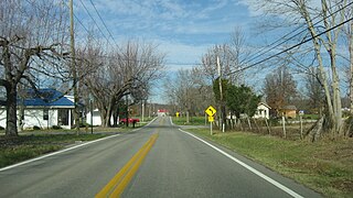
English: Looking northward along State Route 133 at the unincorporated community of Mount Olive, in far northern Franklin Township, Clermont County, Ohio, United States. |
||
| Date | Taken on 23 November 2013 | ||
| Source | Own work | ||
| Author | Nyttend | ||
| Permission (Reusing this file) |
|
File history
Click on a date/time to view the file as it appeared at that time.
| Date/Time | Thumbnail | Dimensions | User | Comment | |
|---|---|---|---|---|---|
| current | 02:29, 2 December 2013 | | 2,816 × 1,584 (1.48 MB) | Nyttend | {{Location|38|53|12|N|84|5|31|W}} {{Information |Description={{en|Looking northward along {{w|Ohio State Route 133|State Route 133}} at the {{w|unincorporated area|unincorporated community}} of {{w|Mount Olive, Ohio|Mount Olive}}, in far northern {{w|F... |
File usage
The following 2 pages use this file:
Global file usage
The following other wikis use this file:
- Usage on en.wikipedia.org
- Usage on eu.wikipedia.org
- Usage on fa.wikipedia.org
- Usage on pt.wikipedia.org
- Usage on vi.wikipedia.org
- Usage on www.wikidata.org
- Usage on zh.wikipedia.org