File:Upper Missouri Breaks NM (8914211947).jpg
Original file (4,320 × 2,879 pixels, file size: 5.2 MB, MIME type: image/jpeg)
This is a file from the Wikimedia Commons and may be used by other projects. Information from its description page there is shown below.
Commons is a freely licensed media file repository. |
.jpg)
Summary
| Description |
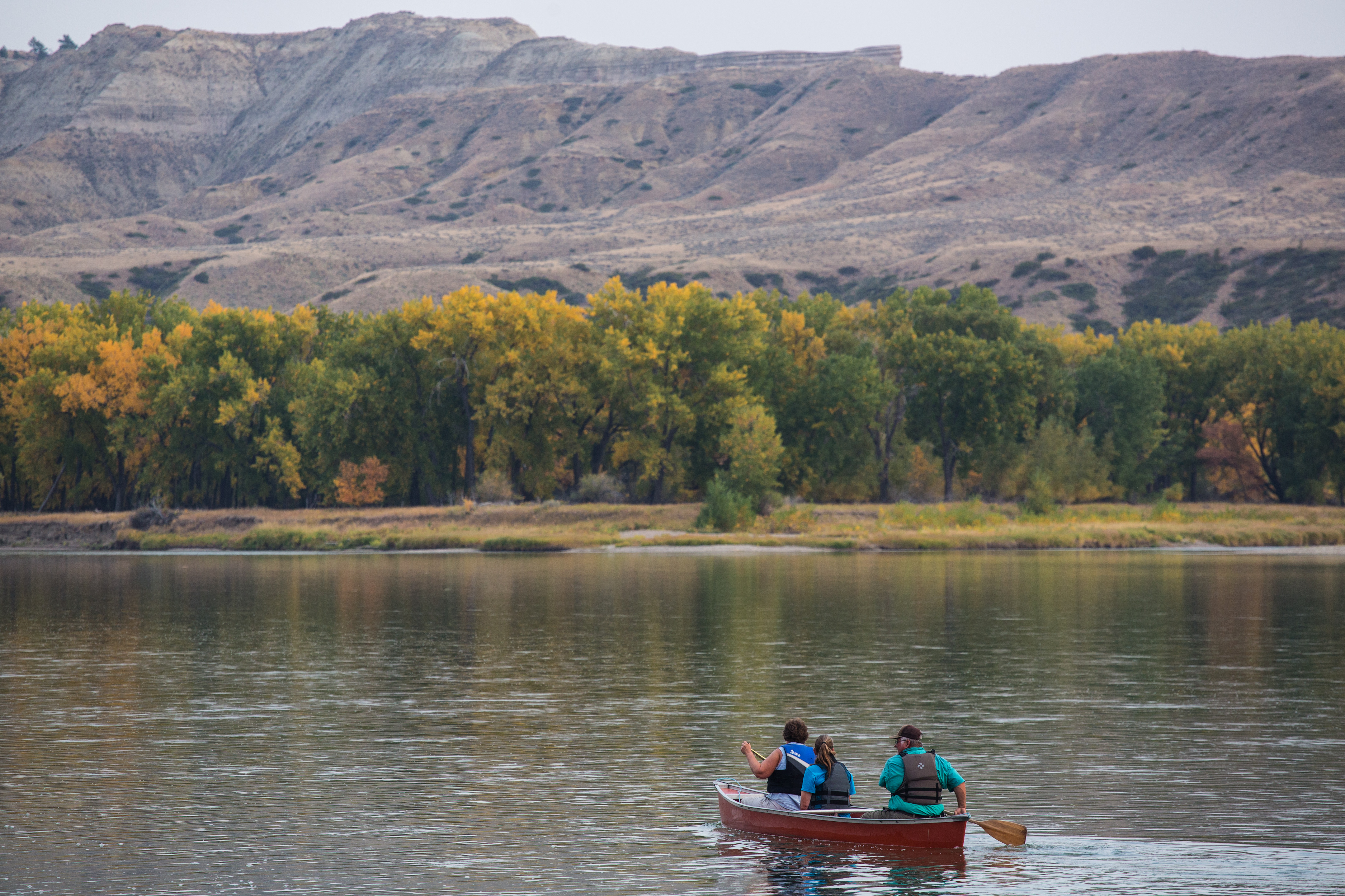
The Upper Missouri River Breaks National Monument covers about 375,000 acres of BLM-administered public land in central Montana. These lands hold a spectacular array of plant life, wildlife, unique geological features, endless recreational opportunities and significant historical and cultural values. The rugged landscape has retained much of its unspoiled character over the centuries and, as a result, offers outstanding opportunities for solitude and dispersed recreation. The 149-mile Upper Missouri National Wild and Scenic River flows through the monument. The land and the rugged, surrounding uplands (commonly call the Missouri Breaks) are defined in part by their history. The entire region was the homeland and lifeblood of American Indians. The river served as the pathway for Lewis and Clark, then the waterway for steamboats and a drawing card for fur trappers and traders. Later, the river and the Missouri Breaks were sanctuaries for desperados trying to stay a step ahead of the law. The land was also a source of hope and inspiration for several generations of homesteaders. Today the public lands in the monument make a significant contribution to the local lifestyle and the regional economy. Within the monument you can float the river, fish, hike, hunt, drive for pleasure, find a little solitude, enjoy a sense of exploration or simply marvel at the variety of resources around you. If you cannot float the Upper Missouri or visit the backcountry, you'll still be able to experience the cultural and natural history of the monument at the Missouri Breaks Interpretive Center at 701 7th Street, Fort Benton, Montana. For more information, visit on.doi.gov/Mkrw5B Photo by Bob Wick |
| Date | |
| Source | Upper Missouri Breaks NM |
| Author | Bureau of Land Management |
Licensing
- You are free:
- to share – to copy, distribute and transmit the work
- to remix – to adapt the work
- Under the following conditions:
- attribution – You must give appropriate credit, provide a link to the license, and indicate if changes were made. You may do so in any reasonable manner, but not in any way that suggests the licensor endorses you or your use.
| This image was originally posted to Flickr by mypubliclands at https://flickr.com/photos/91981596@N06/8914211947. It was reviewed on 5 August 2015 by FlickreviewR and was confirmed to be licensed under the terms of the cc-by-2.0. |
| This image is a work of a Bureau of Land Management* employee, taken or made as part of that person's official duties. As a work of the U.S. federal government, the image is in the public domain in the United States. *or predecessor organization |
File history
Click on a date/time to view the file as it appeared at that time.
| Date/Time | Thumbnail | Dimensions | User | Comment | |
|---|---|---|---|---|---|
| current | 20:45, 4 August 2015 | | 4,320 × 2,879 (5.2 MB) | Wilfredor | Transferred from Flickr via Flickr2Commons |
File usage
The following page uses this file:
.jpg)