File:Veduta aerea di Siracusa e con l'Etna sullo sfondo (Foto di Angelo Bonomo).jpg

Size of this preview: 800 × 477 pixels. Other resolutions: 320 × 191 pixels | 640 × 382 pixels | 961 × 573 pixels.
Original file (961 × 573 pixels, file size: 291 KB, MIME type: image/jpeg)
This is a file from the Wikimedia Commons and may be used by other projects. Information from its description page there is shown below.
Commons is a freely licensed media file repository. |
| Camera location | | View this and other nearby images on: OpenStreetMap |
|---|
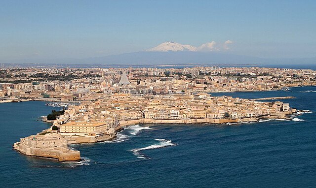
| Description | SIRACUSA VISTA DALL'AEREO CON L'ETNA SULLO SFONDO.FOTO Di Angelo; Syracuse with Mount Etna in the background | |||||
| Date | ||||||
| Source |
SIRACUSA VISTA DALL'AEREO CON L'ETNA SULLO SFONDO.FOTO Di Angelo
|
|||||
| Author | I FRATELLI ANGELO e GIORGIO BONOMO from Pomezia, ROMA, ITALIA | |||||
| Permission (Reusing this file) |
|

.jpg)
.jpg¶ms=037.059261_N_0015.295060_E_globe:Earth_type:camera_source:Flickr_&language=en)
File history
Click on a date/time to view the file as it appeared at that time.
| Date/Time | Thumbnail | Dimensions | User | Comment | |
|---|---|---|---|---|---|
| current | 20:37, 2 May 2014 | | 961 × 573 (291 KB) | Lomita | Suppression tag |
| 23:21, 11 December 2012 |  | 1,000 × 614 (124 KB) | File Upload Bot (Magnus Manske) |
File usage
The following page uses this file:
Global file usage
The following other wikis use this file:
- Usage on az.wikipedia.org
- Usage on bn.wikipedia.org
- Usage on co.wikipedia.org
- Usage on cr.wikipedia.org
- Usage on cs.wikipedia.org
- Usage on cv.wikipedia.org
- Usage on de.wikipedia.org
- Usage on el.wikipedia.org
- Usage on el.wikivoyage.org
- Usage on en.wikipedia.org
- Usage on es.wikipedia.org
- Usage on fa.wikipedia.org
- Usage on fi.wikipedia.org
- Usage on fr.wikipedia.org
- Usage on hu.wikipedia.org
- Usage on io.wikipedia.org
- Usage on is.wikipedia.org
- Usage on it.wikipedia.org
- Usage on it.wikivoyage.org
- Usage on ja.wikipedia.org
- Usage on ko.wikipedia.org
- Usage on lld.wikipedia.org
- Usage on mk.wikipedia.org
- Usage on mt.wikipedia.org
- Usage on oc.wikipedia.org
- Usage on pl.wikivoyage.org
- Usage on pt.wikipedia.org
- Usage on qu.wikipedia.org
- Usage on ru.wikipedia.org
- Usage on ru.wiktionary.org
- Usage on sco.wikipedia.org
- Usage on sd.wikipedia.org
View more global usage of this file.
.jpg)
.jpg)