File:Vue d'ensemble La Roque-sur-Cèze.JPG

Size of this preview: 800 × 533 pixels. Other resolutions: 320 × 213 pixels | 640 × 427 pixels | 1,024 × 683 pixels | 1,280 × 853 pixels | 2,560 × 1,707 pixels | 3,216 × 2,144 pixels.
Original file (3,216 × 2,144 pixels, file size: 3.24 MB, MIME type: image/jpeg)
This is a file from the Wikimedia Commons and may be used by other projects. Information from its description page there is shown below.
Commons is a freely licensed media file repository. |
| Description |
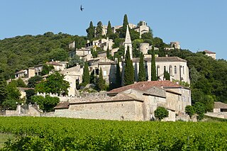
Français : Vue d'ensemble La Roque-sur-Cèze. |
| Date | |
| Source | Own work |
| Author | Vi..Cult... |
| Permission (Reusing this file) |
Attribution ShareAlike 3.0 |
| Camera location | | View this and other nearby images on: OpenStreetMap |
|---|
This file is licensed under the Creative Commons Attribution-Share Alike 3.0 Unported license.
- You are free:
- to share – to copy, distribute and transmit the work
- to remix – to adapt the work
- Under the following conditions:
- attribution – You must give appropriate credit, provide a link to the license, and indicate if changes were made. You may do so in any reasonable manner, but not in any way that suggests the licensor endorses you or your use.
- share alike – If you remix, transform, or build upon the material, you must distribute your contributions under the same or compatible license as the original.
File history
Click on a date/time to view the file as it appeared at that time.
| Date/Time | Thumbnail | Dimensions | User | Comment | |
|---|---|---|---|---|---|
| current | 22:05, 10 August 2008 | | 3,216 × 2,144 (3.24 MB) | Vi..Cult... | {{Information |Description={{fr|Vue d'ensemble La Roque-sur-Cèze.}} |Source=moi-même |Date=june 2008 |Author=Vi..Cult... |Permission=Attribution ShareAlike 3.0 |other_versions= }} {{cc-by-sa-3.0}} Category:La Roque-sur-Cèze |
File usage
The following page uses this file:
Global file usage
The following other wikis use this file:
- Usage on de.wikipedia.org
- Usage on eo.wikipedia.org
- Usage on fr.wikipedia.org
- Usage on fr.wikivoyage.org
- Usage on gan.wikipedia.org
- Usage on hy.wikipedia.org
- Usage on it.wikivoyage.org
- Usage on ja.wikivoyage.org
- Usage on oc.wikipedia.org
- Usage on pt.wikipedia.org
- Usage on ru.wikipedia.org