Puerto Ayacucho is a city of 126,000 people (2011) in Guayana, Venezuela, across the Orinoco River from the Colombian village of Casuarito.

Understand
editPuerto Ayacucho was founded to facilitate the transport of goods past the Atures Rapids on the Orinoco River in the late 19th century (mostly rubber). The Venezuelan army and navy are based here.
The climate is equatorial and the surrounding rainforests are some of the world's least explored and most untouched. The nearby forested mountains (tepuis) contain some of the world's least investigated microsystems.
90 km to the east is the second highest waterfall in Venezuela, the 2,200 ft (670 m) Yutaje Falls. The surrounding rainforest contains some facilities for tourists, including an airstrip, and the area also has a large population of greenwing macaws, Ara chloroptera. There are also jaguars, pink river dolphins, numerous monkeys and other bird life.
The inhabitants are mostly mestizo – of mixed indigenous and Spanish descent. There are a number of local indigenous tribes including the Yanomami, the Panare, the Bari, Piaroa, and Guajibo (also known as Jibis).
Get in
editBy road
editTwo national highways connect it with the rest of the country:
- Troncal 12, via Caicara del Orinoco.
- Troncal 2, via San Fernando de Apure, which intercepts Troncal 12 in the vicinity of Puerto Páez, Apure State.
By plane
edit- 1 Cacique Aramare Airport (PYH IATA) (south of the city). The national airline Conviasa, which has one daily flight from the Simón Bolívar International Airport (Caracas). Local flights depart from Cacique Aramare Airport to other towns in the state, such as San Juan de Manapiare, Maroa, San Fernando de Atabapo, San Carlos de Río Negro and La Esmeralda.
Get around
editSee
edit
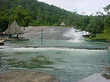
- 1 Tobogán de la Selva. It is a large slab (rock) through which water flows forming a natural slide that ends in a pool of cold water.
- Rómulo Betancourt Square: Popularly known as "Plaza de Los Indios", it is a place where the indigenous people of the area come to sell their handicrafts.
- 2 Ethnological Museum of Amazonas "Monsignor Enzo Ceccarelli" (on Av. Río Negro, near Bolívar Square). History is told in detail since the arrival of the missionaries. The exhibits show the history of the indigenous Piaroa, Guajibo or Jivi, Yanomami, Arawak, and Yekuana. There are original objects and reproductions.
- Cathedral Maria Auxiliadora: built in 1952, in whose interior there is an enormous Christ painted in oil.
- Indigenous Market.
- Bolivar Square.
- Cold Mountain.
- Tourist center "La Perla NegraRaudales de Atures and Maipures.
- The viewpoint of Monte Bello.
Do
edit- Visit one of the spas: Pozo azul, Pozo cristal, Los Márquez, Las Tinajas.
Buy
editEat
editDrink
editSleep
editConnect
editGo next
editThere is a hairdresser along the avenida orinoco, on the left hand side as you walk towards to the airport, that offers combined transport to San Fernando de Atabapo (by road up to Samariapo or Morganito, then by river). it leaves at 07:00 in the morning and costs €9 (2010). this could be a good way to get to Puerto Inírida, in Colombia.

