(Redirected from Copán (province))
Honduran Highlands is the central upland region of Honduras.
Cities
edit- 1 Tegucigalpa — the capital, centre of government and largest city.
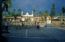
- 2 Comayagua — the former capital of the country is today a quiet colonial town with a beautiful cathedral, notable Spanish architecture and an historic town centre.
- 3 Copán Ruinas
- 4 Corquin
- 5 Danlí
- 6 Gracias — a pleasant colonial mountain town; nearby Parque Celaque is home to the highest mountain in Honduras set among wonderful cloud forests.
- 7 Juticalpa
- 8 La Entrada
- La Paz
- Opatoro - opal mining town
- 9 Santa Rosa de Copán — temperate mountain city in the western part of the region, and the nearest place of any size to Copán Ruinas.
Other destinations
edit- 1 Copán — one of the most impressive ruins of the Maya civilization, known for the quality of its sculpture.
- 2 Lake Yojoa — the largest natural lake in Honduras.
- 3 Ocotepeque
- 4 Patuca National Park — dense rainforest jungles along the Rio Patuca, Honduras's longest river
Understand
editThis region spans the central spine of Honduras from the border with Guatemala in the west to Nicaragua in the east. It consists mostly of mountain ranges and aside from the area in and around the capital, Tegucigalpa, is sparsely populated. This is especially so in the east of the region which is very remote indeed.

The key attractions for travellers are notable Mayan ruins and some charming old colonial hill towns.
Get in
editToncontín International Airport (TGU IATA) in Tegucigalpa.

