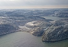
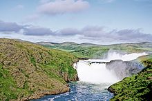
Nunavik (Inuktitut: ᓄᓇᕕᒃ) is the northernmost part of Northern Quebec. It is the homeland of the Inuit people of Quebec. For thousands of years, the Inuit have lived in this vast Arctic territory.

North of the 55th parallel, Nunavik covers some 500,000 km2 (190,000 sq mi), larger than the U.S. state of California. Almost all of the 12,090 inhabitants (2011) of the region, of whom 90% are Inuit (the term "Eskimos" is no longer used in Canada), live in 14 northern villages on the coast of Nunavik and in the Cree reserved land of Whapmagoostui, near the northern village of Kuujjuarapik.
Nunavik means "great land" in the local dialect of Inuktitut and the Inuit inhabitants of the region call themselves Nunavimmiut.
Villages
edit- 1 Inukjuak — a village of 1800 people on Hudson Bay, and home of a museum of Inuit arts and crafts, traditional tools, hunting and fishing gear
- 2 Kuujjuaq — the largest village in the region and the administrative capital of Nunavik
- 3 Kuujjuarapik — the southernmost village in the region, with its twin, Whapmagoostui
Other communities
edit- 4 Akulivik — summer refuge for many bird species in the islands to the north
- 5 Aupaluk — smallest community in Nunavik. It is near the mid-winter migration route of the caribou
- 6 Ivujivik — with fewer than 400 inhabitants, it's Quebec's northernmost settlement
- 7 Kangiqsualujjuaq — the community name is in Inuktitut for "the very large bay". Unfortunately it is easily mixed up with Kangiqsujuaq (see below) which is 450 km northeast of Kangiqsualujjuaq
- 8 Kangiqsujuaq — the community means "the large bay" in Inuktitut
- 9 Kangirsuk — known for its high tides, mussel harvesting and marine wildlife
- 10 Puvirnituq — a community of 1800 people on Hudson Bay, and aviation hub of the Hudson Bay coast
- 11 Quaqtaq
- 12 Salluit
- 13 Tasiujaq — rich in marine wildlife, seabirds and musk ox in the area.
- 14 Umiujaq — the community was created when some relocated from Kuujjuarapik due to the impacts of the James Bay hydro-electric project
Other destinations
edit
- 1 Tursujuq National Park — a national park of Quebec on the east side of Hudson Bay near the village of Umiujaq; it is one of North America's largest parks, with an area of 26,100 km2, making it larger than North Macedonia
- 2 Pingualuit National Park — a very large national park of Quebec (1,134 km2), 100 km southwest of Kangiqsujuaq; it is famous for its crater left by meteor impact
- 3 Qikertaaluk Island – home to one of the best preserved Inuit rock art
Understand
edit
The principal village and administrative centre in Nunavik is Kuujjuaq, on the southern shore of Ungava Bay; the other villages are Inukjuak (where the 1922 documentary film Nanook of the North was shot), Salluit, Puvirnituq, Ivujivik, Kangiqsujuaq, Kangiqsualujjuaq, Kangirsuk, Tasiujaq, Aupaluk, Akulivik, Quaqtaq, Kuujjuarapik and Umiujaq.
Negotiations are underway to create a regional government for Nunavik which would provide more autonomy for the Nunavimmiut people.
There are five meteorite craters in Nunavik: Pingualuit crater, Couture crater, La Moinerie crater and the two craters that together form the Clearwater Lakes.
The Nunavimmiut people carve sculptures from soapstone and eat primarily caribou and fish.
Climate
editThe climate of Nunavik is severe. It is dominated by the long and bitterly cold winters as the seas to the west, east and north freeze over. In summer, when the surrounding sea thaws, temperatures remain low. Inukjuak for example has summer highs averaging just 13 °C (55 °F) with January highs of −21 °C (−6 °F). Annual temperatures are up to 15 °C colder than marine areas of Northern Europe on similar parallels.
Talk
editGet in
editThere are no road links between Nunavik and southern Quebec, although the Trans-Taiga Road of the Jamésie region ends near the 55th parallel on the Caniapiscau Reservoir, several hundred kilometers south of Kuujjuaq.
Parts of the interior of southern Nunavik can be reached using several trails which head north from Schefferville.
Canadian North flies to Kuujjuaq from Montreal, Iqaluit and other airports in the north.
Air Inuit has a year-round service from Montreal, Quebec City and Sept-Îles to every village in the region.
There is seasonal shipping in the summer and autumn.
Get around
editThere are no roads, so you will have to fly from village to village on Air Inuit.
See
edit- Old Chimo: original settlement a few kilometres downstream from Kuujjuaq on the opposite shore.
- Musée Daniel Weetaluktuk (Daniel Weetaluktuk museum), Inukjuak, ☏ +1 819 254-8277. Named for the first Inuit archaeologist in Nunavik, it features contemporary Inuit artwork and over 200 archaeological and historical objects testifying to the origin of the Inuit in Nunavik and their culture. This igloo-shaped museum offers temporary theme exhibitions, educational activities and presentations. The gallery is a replica of the inside of a period igloo. This igloo was built by Inukjuak elders. Reservations are required.
Do
edit- On clear nights, the aurora borealis (Northern Lights) is often visible, and outdoors activities are abundant in this region.
- Atlantic salmon and sea-run trout fishing
- Caribou hunting
Buy
editTraditional craft such as prints and stone sculpture are often sold in the community Co-op store.
Northern Stores and Co-op stores are often the only groceries stores in town. Due to high shipping cost, food is expensive in this part of the country (often double or triple of what you see in major cities). Some of the healthy foods are subsidized by the government so their sticker price is less shocking.
Stay safe
editBe prepared for extremely cold weather, snow blindness, and isolation. While clinics with nurses are available in each town, the nearest emergency hospital can be several hours away by plane.
Go next
edit- Further north to Nunavut
- East to Nunatsiavut

