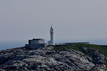
Channel-Port aux Basques is a town of 4,100 people (2016) in the southwestern corner of Newfoundland. It serves as the main point of entry for Trans-Canada Highway traffic arriving by ferry from Cape Breton, Nova Scotia
Understand
editPort aux Basques, a fishing and forestry community, was the western terminus of the Newfoundland railway; the narrow-gauge "Newfie Bullet" train ran from here to St. John's. The railway operated ferries from Port aux Basques to North Sydney in Canada; one of these ships, the ´Caribou', was sunk by a German U-boat during the Second World War with substantial loss of life.
The Trans-Canada Highway follows an approximately similar path to the rail line, which was removed in the 1980s and abandoned as trailway.
The main highway from Port-aux-Basques leads north through Corner Brook and Deer Lake before heading eastward across the northern portion of the island, then south to the Avalon Peninsula and St. John's.
A road eastward from Port aux Basques to Rose Blanche opened in 1961, but travel further along Newfoundland's rugged and sparsely-populated south shore is by coastal ferry. Coastline in the south, largely fjord, is not conducive to road building.
Get in
editBy car
edit- Travel southbound on Highway (Trans-Canada Highway) from Corner Brook. The highway terminates at the Port Aux Basques ferry terminal. Highway 105 in in North Sydney within Nova Scotia is the continuation of the Trans-Canada Highway.
By boat
edit- 1 Marine Atlantic, ☏ +1 902-794-5254, toll-free: +1-800-341-7981, reservations@marineatlantic.ca. Takes passengers and cars from North Sydney, Nova Scotia to Port aux Basques (7 hours) typically two times per day throughout the year. The ferries carry vehicles and passengers. An inter-city bus route services this terminal.
By bus
edit- DRL-LR, ☏ +1 709-263-2171, drl@eastlink.ca. Operates a route daily between Port aux Basques and St. John's with numerous stops including in Stephenville, Corner Brook, Deer Lake, Grand Falls-Windsor, Lewisporte, Gander, and Clarenville. Travel time to Port aux Basques from Corner Brook is 3.25 hours, from Deer Lake is 4 hours, Grand Falls-Windsor is 7 hours, from Gander is 8.25 hours, from Clarenville is 10.75 hours, and from St.John's is 13.5 hours.
By plane
editThere is an airport with scheduled service in Deer Lake. The only major airport is in St. John's.
Get around
editSee
edit
- Gulf Museum, 118 Main St., ☏ +1 709 695-7560, fax: +1 709 956-2170. Jul-Sep: daily 9AM-9PM. Local history, guides in period costume.
- 1 Hook & Line Museum, Burnt Islands. Working museum, live and static displays document the fishing industry. Experience activities such as the baiting of hooks and splitting of fish. Newfoundland restaurant on-site.
- 2 Railway Heritage Centre, 1 Trans-Canada Highway, ☏ +1 709 695-3688. M-F 9AM-8PM, Sa 10AM-6PM. Transportation and fisheries museum, two astrolabes from shipwrecks off Isle aux Morts, souvenir shop, picnic area, washrooms. Price includes tour of train cars and museum. $5.
Do
edit- Walk the boardwalk at the beach.
Buy
edit- 1 Grand Bay Mall, 27 Grand Bay Rd. Has restaurants, department store, grocery store and liquor store.
Eat
edit- 1 Alma's Family Restaurant, 27 Grand Bay Rd (Inside Grand Bay Mall), ☏ +1 709 695-3813.
- 2 Bob's Chicken Coop, 16 High St, ☏ +1 709 695-2762, fax: +1 709 695-5815. 9AM-10PM.
- 3 Pizza Delight, 56 High St, ☏ +1 709 695-9797, fax: +1 709 695-7298.
Drink
edit- 1 Harbourview Bar & Billiards, 157 Caribou Rd, ☏ +1 709 695-6933.
- Lukey's Boat Lounge, 150 Caribou Rd..
- Port Club, 28-30 Caribou Rd., ☏ +1 709 695-2582, fax: +1 709 695-7441.
- 2 Royal Canadian Legion, branch 11, 3 Read St, ☏ +1 709 695-3242, fax: +1 709 695-3981. Legion hall.
Sleep
editHotels
edit- 1 Hotel Port aux Basques, 2 Grand Bay Rd, ☏ +1 709 695-2171. Microwave, refrigerator, room service, Wi-Fi. Restaurant and lounge. Has autism-friendly room. $110-150.
- 2 St. Christopher’s Hotel, 46 Caribou Rd, ☏ +1 709 695-3500, toll-free: +1-800-563-4779, fax: +1 709 695-9841, info@stchrishotel.com.
Bed and breakfast
edit- Heritage B&B, 11 Caribou Rd., ☏ +1 709 695-3240, heritagebb@hotmail.com.
- 3 Right Off Da Boat B&B, 3-4 Dennis Rd, ☏ +1 709 695-2906, fax: +1 709 695-2638, jggillam@hotmail.com.
Stay safe
editAbout 25 km northwest of Port aux Basque on Highway 1, you will come across an area called Wreckhouse. Wreckhouse is known for its extremely high wind speed that can topple vehicles and blow transport trucks off the road (and even railway cars off the track when Newfoundland had railway). Be sure to check the weather forecast for any dangerous wind conditions before passing through this area.
Connect
editNearby
editIsle aux Morts
editOn Route 470 between Port aux Basques and Rose Blanche, named for the many ships wrecked at this location.
Rose Blanche
editThe end of the paved road, the tiny fishing village Rose Blanche on Newfoundland's south shore is named as a corruption of "roche blanche" (white stone, in reference to the local quartz). An isolated community, Rose Blanche was connected to the highway system in 1961 and to the provincial electric grid in 1965. Route 470 ends here, 45 km east of Channel-Port aux Basques; a coastal ferry eastward to La Poile no longer stops in Grand Bruit, now a silent ghost town.
There is one bed and breakfast (Lightkeeper's Inn, +1 709 956-2052) in the village.
- Rose Blanche Lighthouse, ☏ +1 709 956-2052, fax: +1 709 956-2211. 9AM-9PM daily, seasonal. Granite lighthouse constructed 1873 from local stone, badly damaged by a August 1939 storm and left to crumble until it collapsed October 1957, leaving just a tower and staircase. Restored 1996-1999, furnished with 19th-century local antiques and reproductions, historically listed. Scenic view of the Cabot Strait, craft store (+1 709 956-2141) and walking trails.
Go next
edit| Routes through Port aux Basques |
| Antigonish ← North Sydney ← becomes |
W |
→ Jct |

