Niles

Niles is a city of 11,000 people (2019) in West Michigan. Niles lies on the banks of the St. Joseph River, at the site of the French Fort St. Joseph, which was built in 1697 to protect the Jesuit Mission established in 1691. Between 1820 and 1865, Niles was an integral part of the Underground Railroad, helping slaves escape from as far south as New Orleans through the Heartland, and eventually into Canada.
Understand
editAfter 1761, it was held by the British and was captured on May 25, 1763, by Native Americans during Pontiac's Rebellion. The British retook the fort but it was not re-garrisoned and served as a trading post. During the American Revolutionary War, the fort was held for a short time by a Spanish force. The occupation of the fort by the four nations of France, Britain, Spain, and the United States has earned Niles the nickname City of Four Flags.
The town of Niles was settled in 1827. The town was named after Hezekiah Niles, editor of the Niles Register, a Baltimore newspaper.
Get in
edit
By car
editU.S. Highways 12 and 31.
By train
edit- See also: Rail travel in the United States
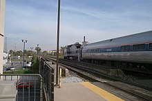
The Detroit Amtrak station

- 1 Niles station, 598 Dey St.


- Amtrak, ☏ +1 215-856-7924, toll-free: +1-800-872-7245. Operates train service around the United States of America. Routes serving Niles:
- Wolverine Service operates several times daily between Pontiac and Chicago including stops along the way in Troy, Royal Oak, Detroit, Dearborn, Ann Arbor, Jackson, Battle Creek, Kalamazoo, Niles, and New Buffalo.
- Blue Water operates daily between Port Huron and Chicago including stops in Flint, East Lansing, Battle Creek, Kalamazoo, Niles, and New Buffalo.
- Amtrak, ☏ +1 215-856-7924, toll-free: +1-800-872-7245. Operates train service around the United States of America.
By plane
editGet around
editSee
edit- 1 Fort St. Joseph Museum, 508 E Main St (at 5th St), ☏ +1 269 845-4054. W-F 10AM-4PM, Sa 10AM-3PM. Features exhibits on Fort St. Joseph, a French fort built in 1691. Located in the former carriage house of the Victorian-style Chapin Mansion; the main house is now Niles city hall. Free.
- 2 Henry A. Chapin House (Chapin Mansion), 508 E. Main St.
Parks
edit- 3 Birkholm Park, Clarendon and 14th.
- Cass Street Park, Cass and 8th St.
- 4 Plym Park, Marmont and Plym Park Rd.
- 5 Eagle Street Park, Eagle and 5th.
- 6 Tot Park, Pokagon and 11th.
- 7 Eastside Park, 17th and Sycamore St.
- 8 Saathoff Park, Maple and 9th St.
- 9 Clevenger Park, Cherry and 5th.
- 10 Riverfront Park. East side of the St. Joseph River from Wayne to Fort St
- 11 Island Park. entrance off Parkway, south of Broadway
- 12 Southside Park, 15th and Silverbrook Ave.
- 13 Troost Park, 8th and Ferry St.
- Cable Street Park, 1400 block of Michigan St.
- 14 Madeline Bertrand County Park, 3038 Adams Rd, ☏ +1 269 683-8280.
Do
editBuy
edit- Michiana Antique Mall, 2423 S 11th St, ☏ +1 269 684-7001, toll-free: +1 800-559-4694, michianaantiquemall@compuserve.com.
- Main Street Antique Mall, 109 East Main St.
Eat
edit- Iron Shoe Distillery, 3 North 3rd St, ☏ +1 269 262-0454, ltuthill@ironshoedistilling.com.
- El Amigo Pepe Restaurant, 1140 S 11th St.
- The Nuggett Downtown Grill and Bar, 202 E. Main St, ☏ +1 269 684-8788.
- Prime Table Restaurant, 1915 11th St, ☏ +1 269 684-2112.
- Pizza Transit, 215 E. Main St, ☏ +1 269 684-6600.
- Jim's Smokin Cafe, 220 E Main St, ☏ +1 269 449-8144. Located in the Paris Soda Company.
- Front Street Pizza Pub, 510 N. Front St, ☏ +1 269 687-4992.
Drink
editSleep
edit- Quality Inn & Suites, 1265 South 11th St, ☏ +1 269 684-3900.
- Spaulding Lake Campground, 2305 Bell St, ☏ +1 269 684-1393, spauldinglakecampground@gmail.com.
- Holiday Inn Express & Suites Niles, 1000 Moore Dr, ☏ +1 269 684-0300. Check-in: 3:00 PM, check-out: 11:00 AM.
Connect
edit- 1 Niles District Library, 620 East Main St, ☏ +1 269 683-8545, info@nileslibrary.net.
Go next
edit| Routes through Niles |
| Chicago ← New Buffalo ← | W |
→ Kalamazoo → Battle Creek |
| Michigan City ← Three Oaks ← | W |
→ Bronson → Coldwater |
| Muskegon ← Benton Harbor-St. Joseph ← | N |
→ South Bend → Indianapolis |