South Central Arizona is a region in Arizona, a state of the United States of America.
Cities
editOther destinations
editUnderstand
editTalk
editEnglish is the primary language although Spanish is widely understood and spoken, with many residents being bilingual.
Get in
editBy plane
editTucson International Airport (TUS IATA), , 7250 S Tucson Blvd, ☏ +1 520-573-8100. Served by a number of airlines, this is the closest airport with commercial service.
By car
editI-10 connects Tucson with Phoenix to the north and New Mexico to the east, while I-19 connects Tucson with Nogales in the south. Smaller highways AZ 83 and AZ 82 provide access from further east along I-10 and from southeast Arizona, respectively.
Get around
editAs there is no public transportation, a car is essential. A four-wheel drive is recommended if you want to get off the beaten track.
See
edit
- The Empire Ranch is a beautifully-situated historic ranch from the 1860s. The area offers good opportunities for a range of outdoor activities, including birding, hiking, and horseback riding.
- The Kentucky Camp is a ghost town and former mining camp which is maintained by the Coronado National Forest. A few buildings have been restored, and for a unique experience visitors can rent one of the buildings for an overnight stay (see listing below).
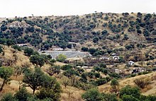
- Ruby ghost town, near Nogales is one of the best preserved ghost towns in Arizona, with ongoing conservation efforts.
- The Fred Lawrence Whipple Observatory near the Madera Canyon has a Visitor and Science Center that showcases astrophysics exhibits, views of the surrounding Santa Rita Mountains and has guided tours of the MMT Observatory.
- 1 Kitt Peak National Observatory (located in Altar Valley, 55 miles (about a 90 minute drive) west of Tucson, at the end of AZ-386 on the Tohono O'odham Nation. From Tucson, take AZ-86 (Ajo Way) west to Jct AZ-386, then left and up the mountain), ☏ +1 520-318-8726, kpvc@noirlab.edu. Site hosts a variety of day-time tours and night-time programs; closed to public Monday and Tuesday. Kitt Peak a "don't miss" for the astronomy buff: there are several astronomical telescopes plus a large solar telescope. Book your tickets in advance.
- Ray Mine. One of the world's largest copper deposits.
- Vineyards. Various, some by appt. The art of wine-making was introduced in the region by the Spanish, and Sonoita makes a good base to explore local vineyards.
Itineraries
edit- Juan Bautista de Anza National Historic Trail. This 1,200-mile trail follows the route of the Spanish exploratory voyage in 1774, beginning in Nogales on the Arizona-Mexico border, heading north through Santa Cruz county to Tucson and then Phoenix, and then west to California. The entire route can be followed by car, and some segments can also be completed on foot. AnzaHistoricTrail.org is helpful for detailed route planning.
Do
editFestivals and events
edit


- The Labor Day Rodeo in Sonoita is a three-day traditional rodeo, held annually in September.
- The Annual Sonoita Horse Races is a weekend of live races in May with Thoroughbreds and Quarter Horses, with betting and food.
Parks and outdoor activities
edit- The Buenos Aires National Wildlife Refuge near Altar Valley was established for the reintroduction of masked bobwhite quail and pronghorn antelope. A number of other mammals and avian species are well-established here, making this an excellent place for watching birds and wildlife.
- Santa Rita Mountains (western access: turn east off of I-19; eastern access: turn west off of Hwy 82 or Hwy 83), ☏ +1 520-281-2296. This mountain range offers great opportunities for hiking, camping, mountain biking, and horse riding. The area is managed by the Coronado National Forest; maps and trail information can be obtained from the Nogales Ranger District office. Free.
- The Madera Canyon is an outstanding place for watching birds and wildlife, with over 250 avian species identified so far. Many trails in the Santa Ritas can also be accessed from the picnic site.
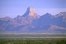
- Baboquivari Peak Wilderness in Altar Valley is a remote wilderness area on the eastern side of the Baboquivari Mountain Range 50 mi (80 km) southwest of Tucson. It is notable for the spectacular Baboquivari Peak. The area offers good opportunities for hiking and photography.
- 1 Ironwood Forest National Monument (I-10, Exit 236 near Marana). Established as a National Monument in 2000, the monument is managed by the Bureau of Land Management (BLM) for multiple uses, including ranching and recreational use. It is noted for significant concentrations of Ironwood trees, and for over 200 pre-Columbian archeological sites. Popular activities include hiking, mountain biking, horse riding, birdwatching, and looking at the many archeological remains. There are no developed facilities, but primitive camping is possible provided campsites are at least 200 ft away from water sources and campers use biodegradable soap. Free.

Stay safe
edit
Outdoors
editAs elsewhere in the region, precautions should be taken to guard against heatstroke and dehydration which can come about very rapidly – always take more water than you think you will need. Heat exhaustion can occur very quickly, with symptoms including dizziness, rapid breathing, heavy sweating, and muscle spasms.
The most commonly encountered wildlife is rattlesnakes, which are active from spring through fall, and tend to hide in brush or in crevices during the heat of the day. The best way to avoid bites is to never place your hands or feet where you haven't looked first. Wear boots or sturdy shoes for outdoor activity. If you are bitten, seek medical attention immediately.
Also commonly encountered are javelinas (peccaries), pig-like mammals which travel in herds. While they generally avoid people, they are very near-sighted and protective of their young, and will attack if they feel at all threatened. Make as much noise as possible so that they are not surprised and panic.
Black bears are found in a few mountain ranges, notably in the Santa Rita Mountains and in the Baboquivari range. When camping, secure your food away from your campsite; when hiking, make plenty of noise.
Drug and human trafficking
editBy 2013, south central Arizona had become a corridor for drug trafficking, particularly in remote areas away from population centers. Hiking and camping in certain areas near the border may be inadvisable; inquire locally as to current conditions, or contact the nearest Border Patrol office (☏ +1-800-232-5378) for guidelines.
The Border Patrol maintains several checkpoints monitoring all north-bound traffic: the 1 Interstate 19 checkpoint north of Tubac, the 2 Arivaca Road checkpoint west of Amado, the 3 Highway 86 checkpoint, and the more mobile 4 Highway 83 checkpoint north of Sonoita. Occasionally there is a 5 Highway 82 mobile checkpoint when the Highway 83 checkpoint is not operating. Drivers passing through should lower their windows; agents may ask limited questions regarding residency or immigration status of any driver or passenger, although frequently they will simply wave cars through. You do have the right to refuse to answer such questions, but this could result in detention while your immigration status is verified.
Go next
editHead north to Phoenix, or cross into Sonora, Mexico through Nogales. Neighboring southeast Arizona is also easily accessible.

