User:Pbsouthwood/(WT-en) Pbsouthwood archives
| This is the imported user page of user Peter Southwood, Pbsouthwood on wikitravel.org/en. All contributions that this user had made on Wikitravel up until August 2012 were imported. The imported revisions of this contributor are labelled as "(WT-en) Pbsouthwood". |
| Read more about the Migration from Wikitravel. |
Peter Southwood

| |||||
| |||||
| |||||
|
Cape Town Dive Festival |
I am surveying and mapping the dive sites of Cape Town as a long term project. Wikitravel is how I make this information available to the public on a constantly updated format.
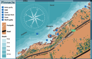
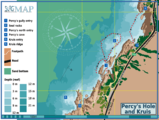
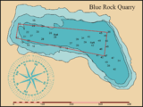
Most of the surveys are done by towing a surface marker buoy on a tight tether along a chosen contour, then after the dive I download the GPS track and transfer it to Inkscape and trace around it to show the shape of the site. A similar process is used for the outlines of reefs and wrecks, and some details are simply measured and sketched on site. On rare occasions the visibility is good enough to use photos and video to provide details.
Since March 2011 I have had access to unpublished data from the SA Council for Geoscience which did a sidescan sonar survey and fascies interpretation of parts of False Bay and the Atlantic seaboard of the Cape Peninsula for a reef ecology monitoring project. This data lacks detail of depth and can be difficult to interpret with precision, but it is excellent for identifying roughly where all the rocky areas are. However it is limited to places where the sonar fish is not likely to hit rocks, so there is still plenty of reef that has to be identified and mapped in other ways in the close inshore zone, Also it does not give depth profiles. The main value is that it is possible to be reasonably sure that most reef has been identified in these zones.
Most of the boat access sites were mapped from Blue Flash charters boats, as Blue Flash caters largely for a fairly regular clientele of advanced local divers, and is more inclined towards exploring new areas and opening up new sites, and a moderate number from Dive and Adventure and Pisces Diving boats. The owners support this project by allowing me a special rate for boat dives. The shore dives were done under my own power, usually alone, but sometimes with a few buddies who are prepared to swim along with me while I survey.
I would welcome participation from other local divers, but so far I have been unable to persuade any of them to actually go out and survey.
Contact me by leaving me a message on my talk page (preferred), or via email, if necessary.
|
Winter diving season appears to be back. False Bay sites will be updated again. Lots to do, with the festival coming up! |
Shortcuts
- Diving the Cape Peninsula and False Bay
- Diving in South Africa, Diving in South Africa/Sardine run and Diving in South Africa/SS Cariboo wreck
- Scuba diving
- Cruising on small craft
Other South African dive regions
External
- http://shared.wikivoyage.org/wiki/Special:Upload
- WikiPedia:User:Pbsouthwood
- SURG home page
- Open Dive site Directory
- http://en.wikipedia.org/wiki/Help:Wiki_markup
- http://en.wikipedia.org/wiki/Help:HTML_in_wikitext
- http://en.wikipedia.org/wiki/Help:Visual_file_markup
- http://en.wikipedia.org/wiki/Wikipedia:Extended_image_syntax
User pages
- (WT-en) List of Dive sites of CP&FB
- (WT-en) Scratchpad
- (WT-en) Wikivoyage dive site map specifications
- User:(WT-en) Pbsouthwood/Reef types
- (WT-en) Templates
- (WT-en) Scuba Diving and dive region and site article listing for export
- User:(WT-en) Pbsouthwood/Personal pages listing for export
Shortcuts to galleries
Images used on dive site articles uploaded to Wikivoyage Commons
- (WT-en) Image gallery for Aerial photos from DGS&M
- (WT-en) Image gallery of own photos for Cape Peninsula and False Bay dive sites A to B
- (WT-en) Image gallery of own photos for Cape Peninsula and False Bay dive sites C to F
- (WT-en) Image gallery of own photos for Cape Peninsula and False Bay dive sites G to M
- (WT-en) Image gallery of own photos for Cape Peninsula and False Bay dive sites N to Q
- (WT-en) Image gallery of own photos for Cape Peninsula and False Bay dive sites R to S
- (WT-en) Image gallery of own photos for Cape Peninsula and False Bay dive sites T to Z
- (WT-en) Image gallery of own photos of Nudibranchs for Pinnacle gallery
- (WT-en) Image gallery of own photos for Aliwal Shoal and Guinjata Bay sites
- (WT-en) Image gallery for photos from other photographers used for dive sites
- (WT-en) Image gallery for images with copyright expired due to age
- (WT-en) Image gallery of own photos for south coast dive sites
- (WT-en) Image gallery of own photos for Eastern Cape dive sites
Wikivoyage useful links
Location
Roles
My home turf is the Cape Peninsula and False Bay, in which region I have logged over 1000 dives at a large range of sites, some of which I have mapped. I am not currently affiliated to any recreational diving certification agency, nor employed by a dive shop or dive charter business.
- Please feel free to ask me any questions about these topics and I will try to provide a useful answer.
Projects
Current projects
The first and main project: Diving the Cape Peninsula and False Bay
I would also like to extend the range of dive sites to other parts of the country, preferably with collaboration from divers who live in the areas.
- (WT-en) List of Dive sites in the project
- The regional dive guide Diving the Cape Peninsula and False Bay has been promoted to star (28th November 2010)
Dive sites with star potential: — to be upgraded at about 1 site per season (summer/winter)
- Diving the Cape Peninsula and False Bay/Smits Reef
- Diving the Cape Peninsula and False Bay/Coral Gardens (Oudekraal)
- Diving the Cape Peninsula and False Bay/Justins Caves
- Diving the Cape Peninsula and False Bay/Geldkis
- Diving the Cape Peninsula and False Bay/Strawberry Rocks
- Diving the Cape Peninsula and False Bay/Star Wall
- Diving the Cape Peninsula and False Bay/North Paw
- Diving the Cape Peninsula and False Bay/Castle Rocks
- Diving the Cape Peninsula and False Bay/Long Beach Simon's Town
- Diving the Cape Peninsula and False Bay/SS Clan Stuart
- Diving the Cape Peninsula and False Bay/SAS Fleur
- Diving the Cape Peninsula and False Bay/Atlantis Reef
Other projects
- Getting Scuba diving up to star standard.
- Diving in South Africa is intended as an article between Scuba diving and local diving guides for South Africa.
- Assisting with Diving in Hermanus, Diving the Tsitsikamma, Diving Sodwana Bay, Diving Aliwal Shoal and other regional guides
- Developing and standardising structure for continental, national and local level diving guide articles. Producing templates where they may be useful. Editing diving guide articles to get them to fit the current structure, and hopefully not offending too many past contributors to these articles.
- Providing help articles on how to create and edit dive guide articles.
- Keeping an eye on any developments in SNUBA, Snorkeling and WV:Free diving
More or less finished and maintenance projects
Star sites and articles
- Diving the Cape Peninsula and False Bay/Pinnacle has reached star status as of 3/12/2009. See archived discussions
- Diving the Cape Peninsula and False Bay/Partridge Point has reached star status as of 24/09/2010. See archived discussions
- Diving the Cape Peninsula and False Bay/Photographer's Reef has reached Star status as of 12/11/2010. See archived discussions
- Diving the Cape Peninsula and False Bay has reached star status as of 28/11/2010. archived discussions
- Diving the Cape Peninsula and False Bay/Percy's Hole has reached star status as of 30/05/2010. See archived discussions
- Diving the Cape Peninsula and False Bay/MV Aster has reached star status as of 29/08/2011. See archived discussions
Other articles
- Maintain Diving in Thailand
- Maintain Dive sites of Saipan
- Maintain Diving in Sweden
- Maintain Diving in the Philippines
Templates
Planned projects
- Developing Dive Guides for the whole of South Africa with the collaboration of divers in other parts of the country. Unfortunately, to date (July 2010) have had no input from other parts of the country.
- Update (October 2010): Some inland sites are now available, and Diving in Durban is based on the work of Bryan Hart of Durban Undersea Club.
Dream projects
- Eventually extending this system of Dive Guides and Dive Site descriptions to other parts of the world. This will have to be done as a major collaborative project and will necessarily involve input from hundreds of divers. Today, Cape Town, Tomorrow, ze Vorld! Ahahahahaha!!!!!!!!!.... Should keep me busy indefinitely.
Other interests include
- SURG (Southern Underwater Research Group) co-founder.
- Engineering, particularly underwater and low-cost solutions
- Underwater science, particularly marine invertebrates of my home waters.
- Underwater diving, Scuba and Surface supplied, scientific and recreational/technical, since 1983.
- Mapping dive sites
- Recording biodiversity of the local temperate reefs. FIN and Reef Atlas Project.
- Reef classification.
- Design and development of special purpose equipment for diving and underwater projects (Modular Diving Systems by Southwood Marine, and SURGware)
- Voluntary and contract work on scientific and commercial diving projects as diver and diving supervisor.
- Education, particularly relating to scientific, commercial and recreational diving. (Commercial diving instructor, ex lecturer at University of Stellenbosch, retired recreational diving instructor)
- Writing training material for commercial and recreational diver training.
- Providing comments and advice on scientific and commercial diving legislation, codes of practice, operating procedures and training policy in South Africa.
Lists
Maps
Dive sites of the Cape Peninsula and False Bay
- Distribution of the dive sites of the region
Sub-region maps
- Dive sites from Robben Island to Camps Bay
- Dive sites from Oudekraal to Hout Bay
- Dive sites from Kommetjie to Olifantsbospunt
- Dive sites from Kalk Bay to Rocklands Point
- Dive sites from Miller's Point to Buffels Bay
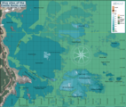
- Offshore dive sites of False Bay
- Dive sites of the Gordon's Bay area
- Dive sites from Rooi-els to Hangklip
Dive site maps - Atlantic Seaboard
- Daeyang Family wreck dive site map
- Hypatia wreck dive site map
- Highfields wreck map
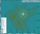
- Map of the dive site at the wreck of the SS Cape Matapan
- Map of the dive site at Sea Point Ridge Pinnacle
- Map of the cave rock area of dive site North Lion's Paw
- North Paw
- Map of the dive site South Lion's Paw
- Map of the Dive site at Cleeve's Tunnel
- Map of the dive site at Dreadlocks Reef
- Dive sites of North Oudekraal
- Sketch map of some wreckage of Het Huis te Kraaiestein
- Map showing location of the north Oudekraal dive site Sandy Cove
- Dive sites of Central Oudekraal
- Dive sites of South Oudekraal
- Coral Gardens (Oudekraal)
- Coral Gardens (Oudekraal) — Detail
- Map of the wreck of the MV Romelia at Sunset Rocks
- 13th Apostle Reef
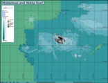
- Middelmas and Hakka Reef
- Ker Yar Vor and the Jo May
- Map of the wreck of the SS Maori
- Dive sites at Duiker Point
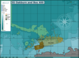
- Oakburn and Bos 400
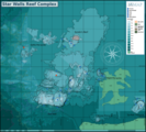
- Dive site Star Wall
- Map of the dive site at Vulcan Rock
- Map of the dive site at Klein Tafelberg reef
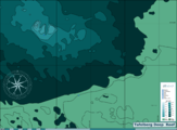
- Map of the dive site at Tafelberg Deep Reef
- Map of the wrecks of the MV Aster and MV Katsu Maru
Dive site maps - West False Bay
- Map of the dive site at the wreck of the SS Clan Stuart
- Map of the dive site at Long Beach, Simon's Town
- Long Beach orienteering map
- Roman, Rambler and Castor Rocks reef map
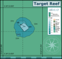
- Target Reef
- Livingstone reef
- Castor Rock Reef
- Tivoli Pinnacles at Roman Rock reef complex
- Roman Rock Reef map
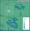
- Friskies Pinnacle map
- Rambler Rocks at Roman Rock reef complex
- Dive sites of the Seaforth area
- Noah's Ark and the Ark rock wrecks
- Maidstone Rock and Maidstone Reef
- Windmill Beach and Penguin Point
- Detail of the reef structure at Photographer's Reef
- Outer Photographer's Reef and Torch Reef
- Detail of the dive site at A-frame
- Map of the dive sites at Oatlands Point
- Rocklands Point: Spaniard Rock, Insanity reef, Alpha reef and others
- Map of the dive sites at Rocklands Point
- Site map showing the position of the wreck of the SAS Pietermaritzburg
- Map of the dive sites at Caravan Reef
- Map of the reef at Boat Rock/Bakoven Rock
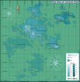
- Dive sites of the Castle Rocks Reef area
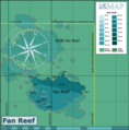
- Fan Reef Map
- Fan reef
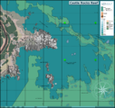
- Castle Rocks reefs
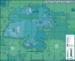
- Pie Rock Reef including Outer Castle
- Pyramid Reef Map
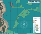
- Shark Alley Map
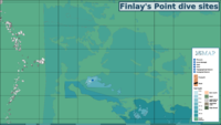
- Map showing dives sites at Finlay's Point
- Map of the dive site Mont Blanc Reef or Finlay's Deep
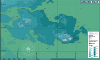
- Map showing the dive site at Atlantis Reef
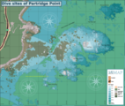
- Map of the reef at the dive sites at Partridge Point
- Detail of the area around the Big Rock at Partridge Point
- Detail of the area east of Seal Rock at Partridge Point
- Detail of the area around Peter's Pinnacles at Partridge Point
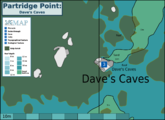
- Map detail showing the positions of Dave's Caves
- GA of the MV Orotava
- GA of the MV Princess Elizabeth
- Sketch plan of the wreck of the SAS Good Hope
- General arrangement of the wreck of the MV Rockeater
- Chart of the wrecks at Smitswinkel Bay
- Map of the wrecks and reef in Smitswinkel bay
- Map of the dive sites at Smits Reef
- Detail map of Batsata Maze
- Map of the reef areas around Batsata Rock
Dive site maps - Offshore
Dive site maps - East False Bay
Dive site maps - Inland
Dive site route maps
Dive site maps of other regions
Other maps
Illustrations
- Sketch of the Mushroom pinnacle showing position of features
- General arrangement sketch of the M.V. Aster
- An impression of the south face of Peter's Pinnacles
- Approximate state of the wreck in June 2006
- The wreck of the Katsu Maru in December 2010
- Wreck of the MV Rockeater in May 2011
- Wreck of the Princess Elizabeth in May 2011
- Wreck of the SAS Pietermaritzburg in June 2011
- Wreck of the SAS Good Hope in July 2011


